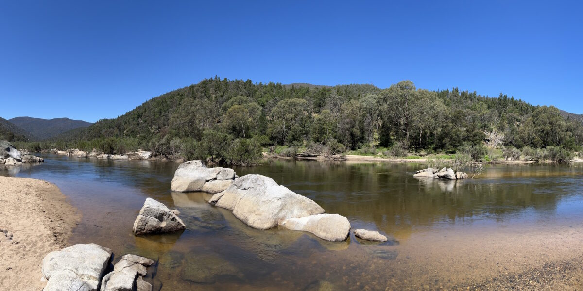
Lead photo: the Snowy River
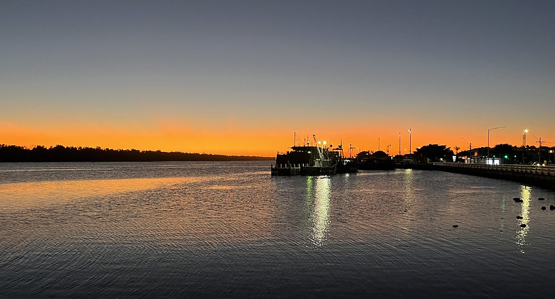
After some time on Friday (6th January) spent exploring the National Gallery and some of Canberra’s public transport, we walked to Kingston Foreshore for dinner.
It’s like a medium-density Docklands, but further from the CBD, and with enough of interest that it actually gets people from other areas visiting. Also a little reminiscent of a smaller-scale Surfers Paradise, but with more warnings about ice on the marina!

On Saturday (7th January) we hit the cafe near the hotel again for breakfast and had a random meeting with the sister of a friend. It’s a small world.
Some of the Freedom Convoy from Thursday passed us while walking to the National Library of Australia to look at the “Viewfinder” photography exhibition, which was very good.
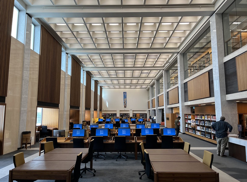
We also had a quick look at the Reading Room, which looked like a very nice space to study. (The blue screens? That’s the terms and conditions for using the computers!)
Then we walked back to the hotel and got the car for a drive to the National Museum – it’s a long walk from the hotel, and the bus (route 53) only runs every 1-2 hours on Saturday. Ugh.
The Museum is very good though, some great displays. We actually got lost at one point, but found the cafe and had a relaxing lunch by the lake.
From there we headed to relatively the new suburb of Greenleigh (east of Canberra City, across the border in NSW) to see my old school buddy Merlin for a catch-up and afternoon tea. Then back to the hotel for dinner, then out to Florey for dessert with one of M’s friends.
Heading home
On Sunday (8th January) it was time to head home.
Having driven north to Canberra along the Hume Freeway (with detours to visit relatives in Yackandandah and Albury) it seemed logical to head back a different, more interesting way.
We got that in spades.
I was aiming for Lakes Entrance, where we’d booked accommodation. I originally thought via Cooma and Cann River (the default route suggested by Google Maps) would make sense… but doing it in one day, there wasn’t a great logical stopping off point for lunch.
Cooma has plenty of options, but it’s only about 90 minutes out of Canberra. After that there aren’t any big towns where you could be confident of good lunch options on a Sunday.
What about via the coast? That would add about 2 hours to the trip. Too far.
So what about via Jindabyne? You still go via Cooma, but reach Jindabyne a bit later, you drive across the top of the dam, there’s great views of the water when stopping to eat in the town. And Google Maps reckoned it was only about 15 minutes longer, via Barry Way.
Google Maps was unequivocally wrong.
I should have known something was amiss when I noticed the road south of Jindabyne had no number – at least not on the NSW side.
But we forged ahead anyway. We stopped at Jindabyne for lunch, bought petrol, then headed south.
First the lines on the road disappeared.
Then the road got narrower.
Then the road was no longer sealed.
Then there were warning signs:
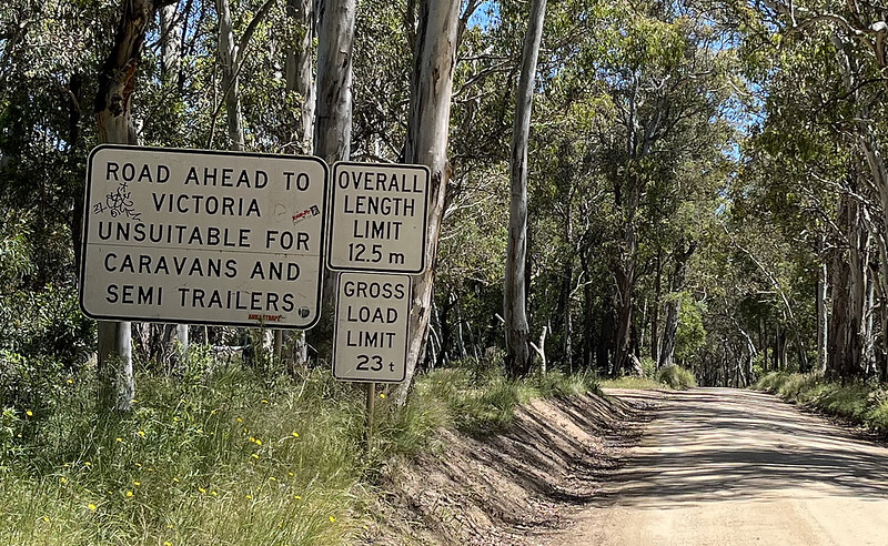
And then we entered the Kosciuszko National Park, and suddenly the road was not just dirt and gravel and narrow, it was heading up and down mountains.
The road went up and up, then down and down, but just when I thought it was all over, it went up again.
The views were fabulous, or so I’m told… I didn’t dare take my eyes off the road.
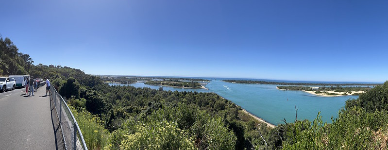
Actually there were a couple of rest stops, one with a look out, and another alongside the glorious Snowy River (see this post’s header photo).

But the rest stops were just a brief respite from the road.
I was happy to be against the wall, only to find it would periodically change, and I’d be next to the edge.
The only silver lining in the cloud was the weather was perfect – no recent rain, no snow making the road even worse than normal.
The last section, after crossing the border into Victoria, was… well, a bit terrifying. The road was narrower than ever before, we were against the edge, and we passed multiple vehicles coming the other way.
Here’s a clip off the dash cam. Please excuse any mild swearing you may hear.
Every blind corner I got to, I was hoping nobody was coming the other way.
And I was very glad we didn’t encounter any other vehicles in sections where it’s too narrow to pass. Backing up would have been no fun for either of us.
By the end, my palms were sweating.
Suddenly the mountains vanished behind us and we were through.
It was such a relief.
A friend said later he’d helped rescue some Dutch tourists whose vehicle had gone partly over the edge. I guess that’s how it happens – two wheels on one side go over, and you’re stuck. Without the rescue, they would have had to wait 48 hours for a tow truck.

Down the road a bit I stopped to check the phone for directions… and to take a breath.
A 4WD pulled up beside me. A working country 4WD, not one of those pointless ones in the city. The window came down.
“Jindabyne?” asked the bloke of our point of origin. He was a man of few words.
Yes, we said.
“Shit road”, he offered. One could only agree.
He nodded at my vehicle. “Not in that car”, he mused.
Yeah, I was thinking he was right.
He reckoned a few more motorists had been going that way recently.
I wonder if it’s Google Maps, totally failing to warn people of the driving conditions?
You can tell it to avoid toll roads, freeways, ferries. What about unsealed roads? What about death-defying cliff faces?
Looking again, Google Maps reckons you could drive the road at average speed of about 70 km/h. I’d say that’s wildly optimistic, unless you have a death wish.
“Cann River!” the bloke said, recommending a different route. Duly noted, sir.
He confirmed the direction of Lakes Entrance, and went on his way.
The rest of the way home was far less eventful. We stayed overnight in Lakes Entrance, then on Monday (9th January) we drove back to Melbourne with lunch in Traralgon, and a short detour via Cape Paterson to visit relatives.
By the time we got home, it was a round trip of about 1600 kilometres.
But remind me never to drive that way from Canberra again.
And to research the route more fully next time.
15 replies on “Off the beaten track”
I did the drive from Jindabyne to Buchan on New Years Eve 2020. I wasn’t as lucky as you, just as I was rounding a sharp corner on the final 10km of narrow road a P plater came tearing round the corner at speed. He very nearly ran me off the road but ultimately he stopped with less than an inch between our cars. I had to reverse as there was no way for him to move without hitting my car. It made for some awesome photos: https://imgur.com/a/4cZZlhy
Google had this route listed as saving 45 minutes over the B road through Bombala and suggested the 171km of which 3/4 is gravel and windy would take only 2.5 hours (averaging 70km/h). There no way a sane driver could average that speed on this road safely. You’d think google would be smart enough to compare the time other vehicles have taken in the past but apparently not and it’s not even fixed 2 years later when you experienced it.
Being 2020 there were the border permit restrictions in force and there were some poor police camped out at the very end of the paved section checking everyone permit. The poor police had one of those terrible portable site offices and were just outside of mobile phone range with what a can only assume were at most a few dozen cars a day to check. I would have died of boredom doing that work.
One somewhat amusing anecdote was that the driver that nearly ran me off the road ultimately appeared in an ABC news article trapped on the wrong side of the border. They’d been camping up the road without phone service and didn’t know the closure had taken effect until they tried to leave. Karma :)
Is that the road through Suggan Buggan? I drove it many years ago; an amazing experience but a few anxious moments as you experienced. It’s one of Victoria’s hidden treasures but probably not for the feint hearted. But you never know if you never go eh?
The V/Line bus from Canberra via Cann River is a good public transport alternative .
Did the Barry Way last January but opposite direction. Amazing trip and the Snowy was in flood, very cool to see. It is a hairy drive though, we did it in a Subie Outback. Hardly any cars coming the other way. Thankfully 😉
Lucky you didnt decide to do a sidetrip to McKillops bridge, heading there from the west I’d say is even scarier than Barry Way.
Some sections are one lane only & sheer cliff so have to be confident with your backing up skills.
From Jindabye, the Alpine Way is a nice drive thru some nice towns & camping areas like Thredbo, Geehi & Khancoban.
Would be interesting if going thru that way via Omeo would work out any slower.
Watching only a couple minutes of that video had me exhausted and brought back traumatic memories of a dirt road somewhere between Bermagui and Canberra that we ended up on in an old, rear wheel drive Ford Falcon with my ‘late breaking’ friend driving, resulting in a lot of slip and slide.
My last 2 cars have been AWD (Subaru Impreza and Kia Sportage) and the difference on a dirt road is amazing. Having had near misses in everyday driving in non-AWD cars (especially in the wet), I’m not sure I would ever go without again, although modern traction control systems these days probably go along way to bridging the gap.
@stirlow, whoa, close call!
I notice a not-so-close call video was posted by Dashcam Owners Australia recently. https://www.facebook.com/DashCamOwnersAustralia/videos/3395799420739714/
Thankfully all the motorists I encountered were driving to the conditions!
The annoying thing is Google Maps has a facility to give feedback on a route immediately after travelling it, but I don’t know if there’s a way to do it later.
I had wondered how it worked during the state border closures.
@Paul, yes Suggan Buggan. I was a bit stressed at that point and couldn’t remember the name later in conversation, only that it rhymed. Was it… Sugar Booger? Oh dear. No disrespect intended. (Found a short history of the place.)
@Able T, might try via Omeo next time!
The dash cam clip is frightening. What do people think!
It’s a pity you did not have the time to see Cooma and its terrific active electricity display (I think you can see it online), and take the time to enjoy Jindabyne.
Nevertheless, in summary it sounds like a great little holiday.
I drove Cann River to Bombala almost 40 years ago in a Datsun 120Y. That trip was also pretty scary, but probably not quite as terrifying as your trip.
One big difference – Cann River to Bombala is 86 km, while Jindabye to Buchan is 172km. So, only half the distance away from civilization.
When I check Cooma to Lakes Entrance on Google Maps tonight, it offered me 3 routes:
1) via Bombala and Cann River – 306km, 3 hours 29 minutes.
2) via Bombala and Orbost – 308km, 4hours 6 minutes
3) via Jindabyne and Buchan – 288km, 3 hours and 48 minutes
So, I think it is saying that via Cann River is the fastest way, via Jindaybyne is the shortest, and via Orbost is the slowest
I travelled that route with some friends in the 1980s in an old Renault 12. The Barry Way hasn’t changed at all in that time.
If that’s the only unsealed road between NSW and Victoria I think I’ve done it too many years ago – in a little hatch – and if so I’ve blocked out the recollection of the road conditions. I think I remember the state border in the middle of nowhere and maybe one of those signs advising speed and red light cameras operate in Victoria.
The Barry way, infamous for rolling a 4WD or two in the wet…
Lunch stops on the road to Lakes Entrance via Cann River
– Nimmitabel (a few options)
– Cann River bakery
– Orbost
The Monaro highway is quite reasonable condition, and there are a few old stations from the Canberra to Bombala railway (closed, but subject to the occasional restoration proposal). Less well know is that there was once a proposal link that line to Victoria via the then Orbost railway line. In 1986 this path was announced as the preferred southern route for a Sydney-Canberra-Melbourne “Very Fast Train” project proposal.
You can submit a report to Google Maps, and I recommend you do, as they do update based on the feedback. I once submitted feedback because their directions from Bairnsdale to Orbost only went via Lakes Entrance, and ignored the inland route via Bruthen which is shorter and avoids the tourist traffic.
My family used to holiday every summer at Karoondah Park at Gelantipy, which is north of Buchan. It’s still there, although these days runs more on the Youth Hostel/backpackers market than family holidays. We did drive to McKillop’s Bridge once, I remember my mother being unnerved by the sheer drop cliff off the side of the road. Little River Falls and Gorge are also very pretty. The locals always advised tourists never to drive further north than the border though.
Google Maps will definitely be the cause of all this. I’ve found its directions are often stupid, and it’s clear that the map doesn’t include information on whether a road is sealed or what kind of grades are involved. And it seems to take the speed limit as the default operating speed of a section, possibly reducing it every time it detects a bend or corner, until it gets enough data from people’s phones to determine a real average speed. And that kind of data would not be forthcoming when there’s no mobile service along the road. Perhaps this is what happens when you make a map without the involvement of a cartographer.
The Barry rd is a stunning drive, and one that every victorian / NSWelsh-person should do at some stage, but preferably duly planned and considered, and not because Google maps sends you there unsuspectingly. I am pleased for you that you got to experience it, and survived.