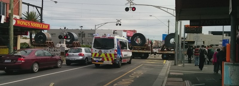
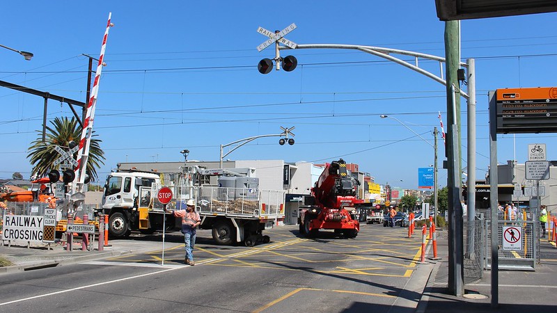
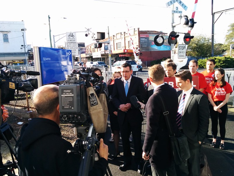
I’ve written before in passing about the freight train from Hastings that heads up from Frankston at about 5pm each weekday, clogging up every crossing along the line, until the pinnacle: it crawls across Glen Huntly Road at about 5:45pm, right in the middle of rush hour.
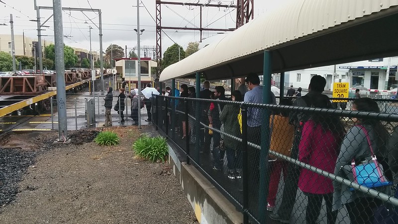
As you can see from this video (shot just before the third track closed), the combination of freight train and tram tracks means the crossing closes for several minutes. An outbound suburban train had arrived as the freight train approached, resulting in a long queue of people to exit the station. By the time the freight train had cleared the crossing, and the passengers got to cross, the next outbound suburban train was approaching.
In this view, you can’t see the effect on the cars and trams, but you can see many pedestrians/passengers get held up — and their delay is just as valid as those people in vehicles. It also affects cars and buses and more pedestrians on nearby Neerim Road.
The freight train might be able to be re-scheduled to outside peak hour, but the delays occur all day, as even suburban trains have a 20 km/h limit on this crossing. This results in long queues of pedestrians, trams and cars, and slows even express trains down to a crawl.
More crossings to be removed
The other week, the government announced another 8 crossings off their list on the southern end of the Frankston line would be removed, starting in 2018. Initially I thought this might mean barely any crossings left on the line, but in fact there’ll still be 19 — there are a lot of crossings!
Is getting rid of them enough to allow a big boost in services on the line? Probably not quite — not while the Glenhuntly crossing with its 20 km/h train speed limit remains, with no main road crossings for a kilometre either side.
On Sunday the government announced another four crossings to be “fast-tracked”. One is in Sydenham and one is in Williamstown North, on the Altona Loop — which can’t get more frequent trains while it remains mostly single track.
The other two are on the single track Cranbourne line — frustratingly, they’ll include provision for rail duplication but not actual duplication — which really would permit more frequent trains, and improve reliability. This is a real missed opportunity — if you’re closing the line and doing a bunch of work on it, why not piggyback on that and fix the single track problem at the same time — at least between Lynbrook and Dandenong, as the last remaining crossing in that section is being removed. (There are two others in the section that includes Thompsons Road.)
Last night at the PTUA Meeting, Public Transport Minister Jacinta Allan was asked about this specific point, and replied that they would look for opportunities to piggyback track duplication projects on top of grade separations. Evidently in this case it’s not happening.
(Marcus Wong has a good blog post with some detail on the Cranbourne line crossings.)
How to prioritise level crossing removals
Level crossings are expensive to grade separate. Some can just be outright closed (this occurred at some spots on the Upfield line in the 90s) but inevitably most need to retain road access. And they’re big projects, so they can’t all happen at once. There are several ways to prioritise them.
The ALCAM model (Australian Level Crossing Assessment Model) which I’ve talked about before evaluates risk, and takes into account factors such as the numbers of trains and vehicles, and visibility. If you’re prioritising due to safety, this is the list to use.
Another strategy is to do crossings along a specific line, which can then open up that line for lots of extra services. This method is being used on the Dandenong line — the plan is all the crossings between Dandenong and the City will be gone within a few years, and in fact also the crossings out to Sydenham (it looks like some smaller crossings will remain on the way to Sunbury), for when the two lines are connected via the Metro rail tunnel.
This can save money and reduce disruptions to the rail line, particularly by doing adjacent crossings at the same time.
Some will want to prioritise rail and road-based public transport. The PTUA in 2010 suggested doing all the tram/train crossings, plus those used by Smartbus and other busy bus routes.
Other people will want to prioritise road traffic. The RACV has a priority list from 2013 which I’d assume highlights those on the busiest sections of road, though they don’t really make it clear. A different RACV list from late-2014 says it highlights crossings in their red spot road user survey, and those with poor safety records.
Obviously politics is a factor. Piggybacking Mckinnon and Centre Roads onto the North Road removal project was a no-brainer in terms of reducing cost per crossing and future disruptions, but also happily for the government they’re all in the marginal electorate of Bentleigh.
(By the way they’ve just confirmed the new Ormond station will include an entrance on both sides of North Road.)
Politics might explain why Glen Huntly Road has missed out. It’s in the non-marginal seat of Caulfield. But train passengers from all the marginal seats down the Frankston line get delayed at Glen Huntly Road on every single trip, so politically it would be of benefit — you could speed up those trains and run more of them. (You’d have to do Neerim Road as well, as it’s only 300 metres away. A new station could sit between the two, providing good connections to connecting bus and tram services on the two roads.)
VicRoads in mid-2014 did a report which has just come out. It highlighted Glenhuntly and numerous others not on Labor’s list. To be fair, Labor hadn’t seen that list when they prepared theirs.
The VicRoads document says they set the priority by taking into account road network operating objectives (tram routes, priority bus routes, preferred traffic routes), travel time savings and vehicle emissions savings (hmm, I wonder if these are proven to be of lasting benefit?) and safety (using incident history).
Naturally the above differing methodologies have a lot of overlaps. For instance a list based on risk is likely to include some of the busiest (for trains and cars) crossings.
Labor’s list
Labor’s strategy was probably a mix of the above — taking in politics, good planning for traffic flow, and rail corridor considerations (the Dandenong line) — but we may never really know. A mix is valid of course, but you’d always hope that politics isn’t the main factor. Most voters are smart enough to know that safety is really important, and that their local quiet crossing probably isn’t as important for removal as That Really Busy Crossing on the other side of town.
Ultimately it’s politics that gets these projects funded. Of course, limited emphasis on other factors is bound to be a risk when the priority list is prepared by a political party, with limited access to government resources.
For better or worse Labor are indicating they will stick to their list of fifty, despite some less than fully logical choices, such as Werribee Street in Werribee, which since RRL opened sees very few trains. (That one is also on both the RACV lists.)
A better way might be for the politicians to pledge to fund the highest priority crossings from a specific, independent evaluation, such as the Vicroads study or the ALCAM list, or taking PTV’s guidance on the best road/rail corridors to address first.
In any case, I hope as these projects get completed, people can see the benefits — fewer bus/tram/pedestrian/cyclist delays, fewer traffic delays, more reliable train services — and the momentum is there from all sides of politics to keep the grade separations coming.
- PS: If you missed last night’s PTUA Annual General Meeting, you missed a great Q+A with PT Minister Jacinta Allan. Join now and don’t miss the next one!


15 replies on “Prioritising level crossings: Safety, traffic, trains and politics”
I think you left out urban planning and renewal as a selection criteria, one which would apply in werribee/glenhuntly/Burke and along the frankston line at the southern end where the freight train isolates residents. Activity centres should have some priority?
Earlier this year i attended a presentation given by Ian Woodcock (I think you might be aware of his ideas). He suggests elevating the rail line and gave the Frankston line between Highett and Frankston as an example of what could be achieved. All level crossings and pedestrian crossings are removed, stations and infastructure is rebuilt and run down areas are renewed for community benefit. Similair projects could be done on the South Morang, Upfield, Craigieburn and Parts of the Hurstbridge, Williamstown, Werribee and Sandringham lines. With proper planning it could be easier than lowering tracks.
The only barrier would be objections by residents concerned about amenity, however if designed well even this can be overcome.
Good point Dean. A good example is the recent Perth City Link project, part of which involved sinking the Fremantle line. http://www.perthcitylink.wa.gov.au/
In Melbourne you might include something like Federation Square (which was adding decking over the lines rather than grade separation)… I’m not sure there have been that many recent grade sep projects driven primarily by urban renewal. You’d always hope they took the opportunity to do it at the same time, but looking at recent examples, I’m not totally convinced there’s that level of co-ordinated thinking.
One small correction, Williamstown North station is on the Williamstown line, not the Altona loop. The level crossing effectively sits in the middle of a 100m-long stretch of road where six roads (or seven, depending on how you count them) come together, two of which (Ferguson St and Kororoit Creek Rd) form one of the two arterial roads that take traffic in and out of Williamstown.
This intersection is nasty at the best of times, but gets seriously backed up when the barrier arms are down.
Apparently there’s also an ALCAM list for pedestrian crossings, but that hasn’t been released. I think it would be interesting to look at, say, Centre Rd Bentleigh as three separate crossings, two pedestrian and one vehicular. After all, the vast majority of level crossing incidents in the last decade have been pedestrian related.
Glenhuntly+Neerim needed to be left out of the current batch because doing that at the same time as Grange Rd thru Poath Rd would have made Caulfield Junction difficult to grade separate.
It might be difficult to get a set of platforms between Glenhuntly and Neerim Rds, due to modern requirements for straight platforms. The curve between the two is about 500m radius, different for each of the three tracks.
Re provision for duplication, was that as “passive” or “active” provision? Apparently passive means no new infrastructure to be built on the alignment of the extra track, while active means building cuttings wider etc. But that doesn’t match with what’s happening at Ormond thru Bentleigh, where apparently passive provision for a fourth track was part of the scope, but the cutting walls and abutments for the new road bridges are all designed for only three.
@Steven: That’s not quite true:
* Williamstown North is actually west of Williamstown town centre.
* North Williamstown station is not in Williamstown North. (It’s technically in Newport.)
* The Kororoit Creek Road x Altona Loop crossing is on the boundary between Williamstown North and Altona, so the government seems to be calling it as in Williamstown North. (Even though it’s in Altona.)
Confused yet?
To add to that:
* The Kororoit Creek Rd x Williamstown line crossing is in Williamstown, despite being right next to North Williamstown station (which, as I said, is in Newport)
@Steven, @Aaron, yeah the crossing that’s been bumped up the priority list is the Kororoit Creek Road crossing on the Altona Loop. As you can see on the official web site map, Ferguson Street is listed separately: http://levelcrossings.vic.gov.au/crossings#maps
@David, I don’t see how Neerim Road is too close to Caulfield junction. It’s 800 metres away, enough at a 2% gradient to climb or descend 16 metres, which is more than double the required clearance for an electrified rail line.
Also there appears to be no immediate plan to grade-separate the junction. The metro rail tunnel people certainly don’t seem to have it on their radar, even though if done it would influence the layout at South Yarra for the tunnel portals, and would be important to provide cross-platform interchange at Caulfield, if rebuilt. I suspect the plan is for cheaper upgrades at Caulfield, such as new subway(s) or overpasses.
The curve between Glen Huntly and Neerim Roads shouldn’t be insurmountable. It’s almost double the length required for platforms (no plans for 9-car trains on the Frankston line; the current grade separations don’t include provision for them) and the rail corridor is wide enough that it should be possible to fit 160 metres of straight platforms.
It would be extremely useful to convert City-Caulfield to up-up-down-down running with a flyover for the down Frankston line just south of Caulfield (Frankston lines on the outside would probably be easiest) and a new platform on the south side at Caulfield to make double island platforms.
This allows valuable same direction cross-platform interchange at Caulfield and Richmond 3/4 & 5/6 (and the possibility of rebuilding Malvern station as double islands 300m north for better interchange with the nearby tram lines).
It also means that, when the Dandenong line is tripled in future, it would be possible to run two peak direction Dandenong tracks to the city when there are spare paths on the Frankston line, without conflicting movements.
Cost? 1x one track flyover plus new platform at Caulfield plus resignalling about 20 track km. Say $300 million? Maybe it sounds like a lot until you reflect that that would be just 3 per cent of a $10 billion Metro Tunnel.
In context of the ENORMOUS cost of the Metro Rail Tunnel I think it would be extremely foolish not to future-proof it to allow this very useful extra improvement.
Grade separations south of Caulfield should take this into account.
Did Jacinta Allen say anything about whether the new grade separations between Caulfield and Dandenong would have provision for 3 tracks, as at Springvale Road ?
I wonder how many of these roads could be just closed off.
Also, nobody can tell me why, the trains need to crawl across the tram squares as they do. People put forward theries, but none really stack up that well.
I prefer an elevated railway to a trench railway. It would also be somewhat cheaper to be done that way too.
As for Caulfield, I would convert #1 into an Island platform, and say both tracks be all up trains, with current #2 and #3 being for all down trains. #4, the current could be there for Gippsland trains only. I like the down-down-up-up idea, that way the UP Caulfield island at Richmond shall be adjacent to the UP Burnley one.
I think it’s a joke that these crossing removals have been sold as a rail project when there are actually no commitments or plans to increase services as a result of the separations. These are road projects and will mainly benefit road users and the govt has used its spin to convince even well informed members of the public like PTUA members that this is a public transport project. I’d much rather them prioritise signalling upgrades than level crossing removals.
[…] for 8 years, and know only too well that the train/tram crossing causes suburban and freight trains to slow to a crawl, delaying pedestrians, trams, cyclists, buses (on nearby Neerim Road), ambulances (there’s an […]
[…] Glen Huntly Road, Glenhuntly. Not ranked very high on the ALCAM safety list, but one of the prime causes of delays to Frankston line trains and route 67 trams alike. It along with nearby Neerim Road (ranked 152) […]
[…] As I’ve noted before, it’s even worse when freight trains rumble through, and/or during peak hour when large numbers of people have to queue to exit the station. […]