It looks like sometime in the past few weeks the PTV/GTFS feeds for Metro trains has subtly changed, so that through routed services are now linked together – at least in some cases. (HT: Rod)
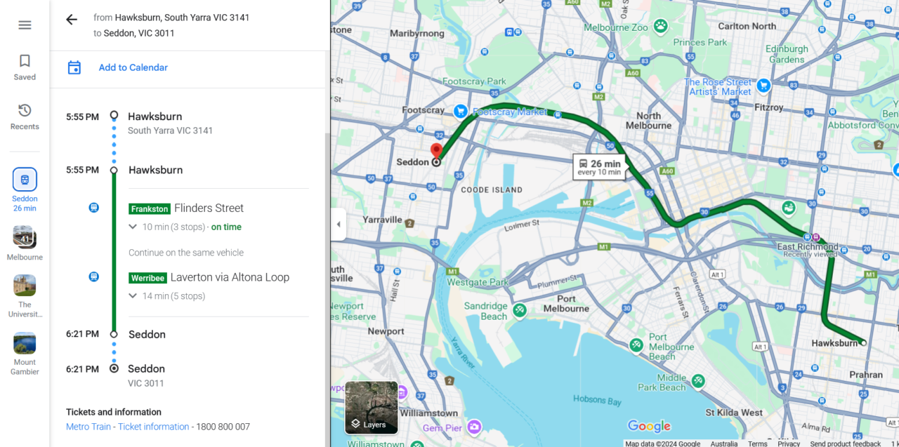
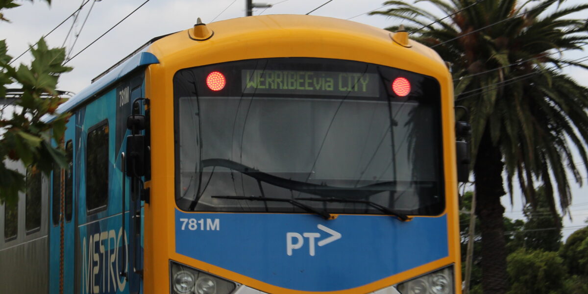
For instance, Frankston line trains mostly run through to Newport/Werribee/Williamstown (the green line on the train map). But until now, if you’d planned to travel across town from say Hawksburn to Seddon, most journey planners would split the trip at Flinders Street, even though you can usually just stay on the train.
This change to the data means that you’ll be advised to stay on the train – though with last minute changes sometimes being made, it usually pays to double-check the platform screens when you get to Flinders Street.
Here’s an example in Google Maps:

This is good.
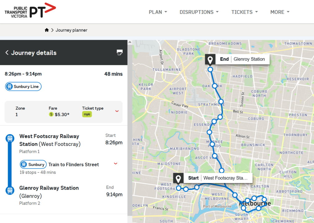
But it has caused one oddity: in some cases trains switch back and forth between lines. This is the case with some Sunbury and Craigieburn line services, particularly in the evenings and on weekends.
It means that if you plan a trip between these two lines, both PTV and Google may suggest that rather than change at the logical place, North Melbourne, you stay on the train, travelling right around the City Loop.

This type of result comes up for some trips on weekdays during daytime, but is more common in the evening and on weekends, where the algorithm decides that since trains are so infrequent, it’s not worth changing at North Melbourne as it won’t save any time.
Of course the automatic “Change here for” announcements on the trains don’t know this, which may be confusing.
And it underscores just how infrequent some of Melbourne’s trains are that often you have time to take a 19(ish) minute detour around the CBD and not miss a connection. It also shows a lack of fast frequent orbital connections.
On the bright side, you might save yourself the bother of changing platforms and trains, get a scenic tour of Melbourne’s most well-known underground tunnels, and stay out of the weather for a bit longer… but at the risk of the train being transposed (destination altered) on the way through.
Why has the data been changed? I’m not sure, but one reason might be preparations for the Metro tunnel, expected to open next year, which will permanently see the Sunbury through routed with the Cranbourne/Pakenham lines.
I’m hoping they take the opportunity to simplify the line names.
UPDATE: Data Vic has an article on this change.


7 replies on “Through routed trains now on journey planners”
A couple of weeks ago I caught a train from Flagstaff that was on the PID as a Lilydale service that ran via Flinders Street and Richmond and – wait, what? Didn’t I learn on Daniel Bowen’s blog that Lilydale trains don’t stop at East Richmond? When did this turn into a Glen Waverley service?
I wish they had this on Hurstbridge ones- it often says you have to change at flinders st to go around the loop when it actually continues around
@neggie, have you checked recently? I just looked on Google Maps and for a trip from Westgarth to Flagstaff it’s showing as one service.
The problem with Clifton hill group trains is, what happens after Flinders Steet is arbitrary. I often step out of the door to check the PID.
This doesn’t work in the real world. It’s made things worse if that’s even possible. The use case I’ve found is when changing at Parliament for an Upfield train in the morning, for example:
Google Maps tells me to take the 8.49 Sunbury to Flinders Street. This is probably because the train has originated at Sunbury before entering the loop, but unless I poke my head in and ask someone if this train came from Sunbury, I don’t know any reasonable way someone would know this…
So then the PIDs at Parliament say 8.49 Upfield, and of course the train PIDs say Flinders Street. No mention of Sunbury anywhere. This would be extremely confusing and is borderline unusable to anyone, in my opinion.
The information feed needs to match the PIDs. This is a very clear example of how consistency is completely lacking in our entire network.
@David, yes, on reflection I think the risk of transposals is still too great. Better to catch the first train to Flinders St in that case (or in the example in the blog post, change at North Melbourne no matter what the journey planner says).
I was at one point, commuting from North Melbourne Station to Oakleigh Station (for the train leg of my commute, my final destination being Heatherton).
At North Melbourne, the PID says the train is going to Frankston (occasionally Carrum). All is well until the moment the train departs Spencer Street and heads towards Flinders Street, there was often enough an announcement saying ‘this train is now terminating at Flinders Street’.
This would then result in me having to be near the door and figuring out which platform it would terminate in (generally 8/9 or 10 but occasionally 12).
Then I would have to sprint to Platform 6/7 or 13 (if it unfortunately went to 12). The latter resulting in a super tight interchange at South Yarra, as I was going from Platform 2 to Platform 6.
I just wish that they tell you earlier that it will turn around at Flinders. This was a consistent problem for me. Even when my commute was shortened to Richmond Station, the same issue still occurred…
Now my commute is bus + tram these days (if I am not driving, which I do more of than at the time) and ironically, it suffers from less issues than my old train + bus + tram/walk commute.