Back in 2014, the then Coalition state government was pushing East West Link. If it had been built it would have been a financial disaster – but as part of the planning process, some interesting documents were released, including one that contained a “base case” expected scenario for the transport network in 2021.
This was an input for the “Zenith” model of journeys around Melbourne. The Zenith model has a number of flaws, as documented by transport planner William McDougall – but it’s the public transport service “base case” assumptions that I’m interested in.
The “base case” is adapted from a PTV planning document from April 2012, and outlines anticipated infrastructure upgrades and service levels for the public transport network by both 2021 and 2031. It wasn’t a government commitment, but was a forward plan.
The bus and tram upgrade plans never fully made it into the public realm, but a version of the train plans was released in the Network Development Plan, also written in 2012, released in early 2013 – but with some differences.
(I’m going to capitalise Base Case from here, because I want to distinguish it from other planning documents such as the PTV NDP.)
I wrote about the bus plans in 2014, but given we’re now in 2021, I was curious to see how things are tracking against what the Base Case assumed back then.

Rail infrastructure
A number of rail infrastructure projects were anticipated – and happily, all were completed.
| Base Case anticipated projects | 2021 actual |
| South Morang extension | Completed 2012 (Also Mernda 2018) |
| Regional Rail Link | Completed 2015 |
| Sunbury electrification | Completed 2012 |
| Maryborough line improvements, Talbot, Clunes, Creswick | Reopened 2013 / 2011 / 2010 |
| Cardinia Road station | Completed 2012 |
| Lynbrook station | Completed 2012 |
| Williams Landing station | Completed 2013 |
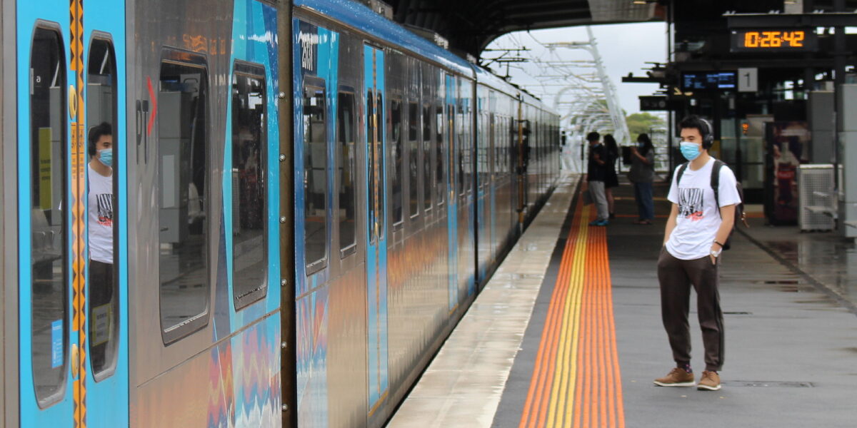
Train services
Public transport infrastructure is useless without adequate services running on it.
The Base Case assumed train operations would be optimised without the Metro tunnel – in other words, pretty close to what we have now. It mentions the Cross City (Frankston-Werribee/Williamstown) services specifically – finally fully implemented in January 2021.
But it also anticipated higher frequencies than we’ve now got (I’ll specifically compare weekday between the peaks, aka inter peak), and interestingly also specified fixed Loop direction for all four tunnels.
| Line | Base Case anticipated Loop direction | 2021 actual Loop direction | Base Case anticipated inter peak frequency | 2021 actual inter peak frequency |
| South Morang (now Mernda) | Clockwise | Clockwise | 15 | 20 |
| Hurstbridge | Clockwise | Clockwise | 30 (15 to Eltham) | 40 (20 to Eltham) |
| Belgrave | Anti-clockwise | Mixed | 20 (10 to Ringwood) | 30 (15 to Ringwood) |
| Lilydale | Anti-clockwise | Mixed | 20 (10 to Ringwood) | 30 (15 to Ringwood) |
| Glen Waverley | Direct | Mixed | 10 | 15 |
| Alamein | off-peak to Camberwell | off-peak to Camberwell | 15 | 15 |
| Pakenham | Anti-clockwise | Anti-clockwise | 20 (10 to Dandenong) | 20 (10 to Dandenong) |
| Cranbourne | Anti-clockwise | Anti-clockwise | 20 (10 to Dandenong) | 20 (10 to Dandenong) |
| Sunbury | Clockwise | Mixed | 20 (10 to Watergardens) | 40 (20 to Watergardens) |
| Craigieburn | Clockwise | Mixed | 10 | 20 |
| Upfield | Clockwise | Mixed | 15 | 20 |
| Werribee | Direct | Direct | 20 | 20 |
| Williamstown | Direct | Direct | 20 (10 to Newport) | 20 (10 to Newport) |
| Laverton | Direct via Altona | Direct via Altona | 20 (10 to Newport) | 20 (10 to Newport) |
| Frankston | Direct | Direct | 9 tph (see below) | 10 (6 tph) |
| Sandringham | Direct | Direct | 10 | 15 |
The Base Case envisaged consistent Loop direction for all four tunnels. Burnley and Caulfield tunnels would run anti-clockwise, presumably to avoid crowding between Parliament and Richmond in the PM peak The other two tunnels would run clockwise. As it is, in 2021, only two out of four Loop tunnels run consistently in one direction.
Lots of lines would have seen an uptick in off-peak frequency: every 10 minutes instead of 15; 15 minutes instead of 20. This all makes more trips more convenient, by reducing the time penalty for changing lines.
Parts of the Frankston line would get 9 trains per hour, because all Werribee/Williamstown/Laverton trains would run through, with those from Williamstown turning back at Mordialloc. It doesn’t mention any off-peak Frankston line express trains, so it’s unclear how they’d have dealt with uneven frequencies. This is different from the PTV NDP, and from reality at present.
Likewise it’s unclear how Upfield (every 15 mins) would have shared the Northern Loop tunnel with the Sunbury and Craigieburn trains (every 10 mins). Again, the Base Case is different from the PTV NDP, which talks about 10/20 minute frequencies for all lines, not 15.
The Base Case also talks about V/Line getting mostly hourly or half-hourly services, including the latter from both Marshall and Geelong (eg every 15 minutes between Geelong and Southern Cross). Since then, DOT has moved towards a 20/40 minute frequency (just introduced on the Ballarat line) which is better than was anticipated.

Bus services
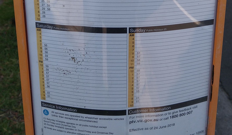
The bus network is critical, being the only public transport in most areas of Melbourne, but are also consistently underserviced.
The Base Case makes it clear that the bureaucracy thought Smartbus was a strong way forward – which makes sense as it’s been wildly successful. The plan built on that success, providing higher frequencies, and more routes: some 43 Smartbus routes by 2021.
| Smartbus upgrades | Base case anticipated | 2021 actual |
| Existing Smartbuses | 703, 900, 901, 902, 903, 905, 906, 907, 908 | Same |
| Upgrades of existing buses to Smartbuses | 207, 215, 216, 238, 246, 251, 400, 406, 446, 468, 472, 478, 506, 510, 548, 561, 624, 630, 691, 732, 737, 791, 822, 828, 841 | None |
| New Smartbus routes | 9 routes | None |
| Smartbus frequency | At least every 10 minutes at all times | Mostly every 15 minutes weekdays; 30 minutes evenings/weekends |
The Base Case also says other routes were also planned to be boosted, with around 70 “Direct” routes running every 20 minutes. While some routes are moving to 20 minute frequencies, these are not particularly common – and include most of the routes that should have been upgraded to Smartbuses.
The Base Case also said about 180 “Coverage” routes would fill in the gaps for people who might choose or might not be able to easily access main road Smartbus or Direct routes. These would run at least hourly.
In reality in 2021, the frequency of much of the bus network on weekends and in the evenings is hourly – the Base Case “Coverage” route standard.
The Base Case also outlined other specific route types where Smartbus, Direct and Coverage weren’t appropriate. Some of these are in place, such as the University shuttles.
A full list of Base Case routes is here. It doesn’t seem to envisage a big network re-design, but perhaps this was seen as something bigger than possible to include for modelling purposes – remembering that a comprehensive review of routes had just taken place.
Trams
I won’t do a big table, but the Base Case anticipated that most trams would run more frequently at most times. Even the evening service would have been every 10-12 minutes on most routes, but up to twice as frequent on the busiest routes such as 19 and 58.
This is good, and would have better matched the heavy all-day travel demand in the inner-city areas the trams serve.
A restructure of tram routes was also included in the Base Case.
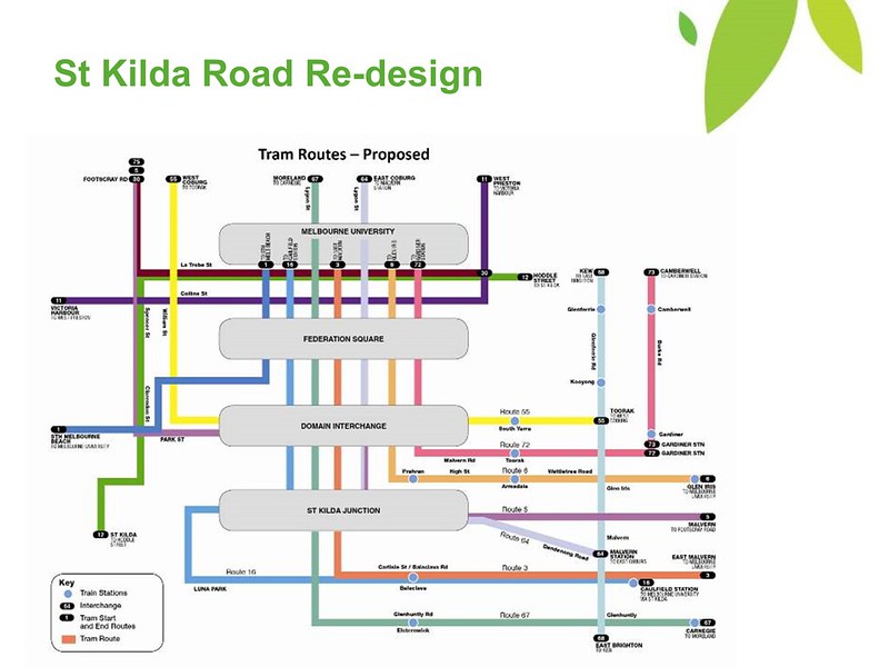
Route changes included:
- Changes to through-routing along Swanston Street: 67 Carnegie to Moreland, 64 through to East Coburg, presumably to better balance out loads and frequencies.
- 64 from City to terminate at Malvern station
- 16 from City to terminate at Caulfield station
- A new route 68 from East Brighton to Kew, taking over the north-south sections of 64 and 16 along Hawthorn and Glenferrie Roads
- 72 from City to terminate at Gardiner station
- A new route 73 from Gardiner to Camberwell
- Route 30 (LaTrobe Street) made fulltime
- Splitting route 112 (St Kilda to West Preston) into two routes: 11 and 12, with the 12 running via La Trobe Street
- Joining routes 55 (West Coburg) and 8 (Toorak)
A lot of this was flagged semi-publicly around this time, in a presentation to the MTF and subsequently some media coverage. Some of it has since been implemented, including the changes to routes 30, 8/55 (which also changed some Swanston Street through-routing). And route 112 was split, but both portions still run via Collins Street – in part because the Free Tram Zone has necessitated more capacity there.
Shortening the 16, 64 and 72 made some sense given these are extremely long routes that almost nobody uses end-to-end, and maintaining punctuality and matching capacity to demand is difficult.
The planned route 68 also makes a lot of sense, providing a more seamless north-south suburban connection across the inner east.
And the planned route 73 could be a precursor to something long proposed: an extension south from Gardiner to Caulfield.
So a lot of this is still pretty logical, and you’d hope they continue to move towards it.
Missing in the Base Case was any mention of extending tram coverage, even the short logical extensions to railway stations, which is a shame.
Good plans
Overall the Base Case plans made a lot of sense. Melbourne was growing fast. Better public transport provision could ensure that a good number of the new trips added wouldn’t be in cars – including non-peak trips when the roads are busy but public transport (especially in the suburbs) is pretty woeful.
This is all still the case. In fact while COVID-19 has resulted in a big drop in peak hour commuting, which may be a lasting change, off-peak journeys have returned strongly. There are very plausible predictions that a big permanent increase in white collar Work From Home will mean travel demand continues to trend towards off-peak and shorter distance local journeys, the latter largely served by buses.
And it’s those woeful suburban bus services in particular which would have benefited hugely had the Base Case upgrades been funded and delivered.

So what happened between the plans in 2012, and 2021? The Coalition government (2010-2014) put in some worthwhile service upgrades on trains, but didn’t do too much on trams and buses. They did lay the groundwork for some big changes for trains and for Transdev buses, but were voted out before they could be implemented. Perhaps they were too busy trying to ensure East West Link happened.
The Labor government (2014-) was more cautious about such sweeping service changes, and focussed almost exclusively on infrastructure: especially level crossing removals and the Metro tunnel, and then from 2018, also the Suburban Rail Loop (as well as multiple motorway projects: North East Link, West Gate Tunnel, Mordialloc Freeway, and widening projects).
Some public transport route changes eventually made it through – including many of the train network changes, and some of the bus and tram route changes.
But many of the service frequency improvements didn’t happen.
There’s huge benefit from running more services, and there’s also a cost. But to put it in perspective, the $16 billion cost of the North East Link motorway is roughly the cost of upgrading the entire suburban train network to run all-day 10 minute services for about 100 years.
North East Link, like every major road project before it, will generate more traffic. Running more trains (and trams, and buses) would get more people using public transport. Transport is supply-led. It’s all a matter of priorities.
Overall, you read the Base Case now and the sense is that at the time, authorities envisaged a huge boost to public transport, growing the frequent network right across Melbourne.
Most of it didn’t happen. We’ve missed out big time.
But it’s never too late to start.
16 replies on “PT services in 2021: planned vs actual”
The split of 72 into 72 and 73 was because of the Gardiner tram square, not because of an extension. That isn’t possible anyway because of the hill from Gardiner to High Street Road, which is too steep for trams to climb at present – about 600m of the road would need to be lowered, with impacts on associated driveways.
Of course, buses from Gardiner (and/or Camberwell) to Caulfield (and/or Moorabbin) would work perfectly fine.
Just interested – where was that bus stop timetable photo taken?
@David, is Burke Road south of Gardiner steeper than Burke Road north of Toorak Road where trams already operate?
@Michael, Tucker Road, McKinnon (route 626)
Thanks Daniel. Interesting and informative, as usual. In an ideal world, such monitoring of planning versus implementation would be driven by parliamentary committees. The bus network is absolutely in need of serious thought and investment – and with so many quick wins (eg. traffic light priority, re-design of entry/exit to major bus terminals, etc). I suggest that all senior DoT executives, cabinet ministers and shadow cabinet ministers be required to travel exclusively on active and public transport for a week.
To Chadstone?
Gradients get brought up a lot for why seemingly logical tram extensions can’t happen. But there’s plenty of steep sections already e.g. the tail end of Route 58’s Toorak terminus, Route 16 between Gardiners Creek and Riversdale Rd etc. We also (ever so slowly) have new trams being built which can presumably handle steeper grades a little easier. Wouldn’t mind seeing some figures to back this all up.
@Nick, there is an official document stating the maximum gradient for trams should be 6.67% https://yarratrams.com.au/media/1892/infrastructure-tram-track-design.pdf
I don’t know if it’s easy to find the information on the current gradients around the existing tram network. Those sections you’ve cited would be good examples to look at.
I would love some information about the tram gradients issue. I cant accept the claim that, Bourke Road is too steep. Also Bourke Street in the city is steep also.
Is there any reason why, those proposed changes to the tram network where not fully fulfilled?
I did hear from somebody, the one reason why E class trams went onto the route 11, to West Preston, was to boost capacity along Collins Street, so they can remove route #12 from it.
Given the East West Link, costed us $1B to not build it, how much was it going to cost to build it?
I would like to have seen those many extra SmartBus routes introduced, especially the many new routes in the plans.
By irony, I visited Wikipedia for the 1969 Transport plans, early this week, just to see how much of it has since been built, especially in respect to freeways. It is no surprise that, most of the freeways have already been built. Only the Healesvile freeway, whos land has been sold off along most of its parts, and something in the St Kilda area. Good luck in getting a freeway through there now days.
In contrast, the only rail improvements was, the City Loop, and some other little bits, including Sunbury, Craigiburn and some others.
In contrast to that, many railways including, Doncaster, Rowville, Dandenong-Frankston, Hastings, Mornington, Coldstream, still dont have a hit of ever happenign any time soon.
@daniel – it is SUPER EASY to find road gradients which are reasonable enough for this application.
Simply go into Google maps and put a from / to into the directions section and select the “cycling or walk” mode. A route profile with elevation gain & distance is shown.
South from Gardiner station to Glendale rd : 26m / 400m, 6%
North of Gardiner: Toorak Rd to Currajong av – 40m / 800m, 5%
Route 16 Gardiners creek to south st: 36m / 650m, 5.5%
Route 58 terminus, Linlithgow rd to Glenbervie rd: 12m / 270m, 4.5%
I would suggest these are pretty comparable ascents and the excuse of grades to extend 72 south (as 73) to Caulfield is a red herring.
A good too map of Melbourne will aid to refine some of these as Google maps isn’t always perfect (eg https://en-au.topographic-map.com/maps/jvbe/City-of-Melbourne/)
Andrew, can you please do the same for, Doncaster Hill, along Doncaster road?
@Andrew, that’s brilliant, thank you!
@Jim, he has clearly explained how to do it for anywhere you like.
Daniel, do you by any chance, have the list of 9 proposed, new SmartBus routes?
@Jim, click on the link in the blog post: “A full list of Base Case routes is here”
@TranzitJim Coldstream and Mornington were still serviced in 1969 (not very well but still serviced). Both lines have since been closed off altogether!
I don’t see Airport, Clyde, Doncaster, Frankston (from Dandenong) or Rowville being done anytime soon. I even question if Baxter or Melton will see electrification, or if Cranbourne will finally gain the second track it’s needed since 1995!
As for the road portions of the 1969 Transportation Plan, only some of the minor radials have been abandoned. All the bypasses, major radials and ring roads proposed have been built in some form between the 1960s – 2008.
Rail Gradients require significant energy to climb which is not recovered in descent. At Cheltenham LXRP Rail under Road the 2017 plans had a long cutting going halfway to Southland station, which is rail over Bay Road. By 2018 LXRP shortened this by around 1/3 with a steeper climb. An energy engineer (I met on the train) said his studies showed the electricity consumption, acceleration and braking etc added running costs whereas the shorter cuttings & flyovers cut construction costs. Perhaps not an issue if we have 100% wind/solar electricity. I wonder if the electricity consumption for trains, trams, electric buses, and the infrastructure for a reliable 100% RE supply has been factored into the grand plans.
[…] they also continue to address more single track sections – and of course better implement service upgrades to go alongside these infrastructure […]