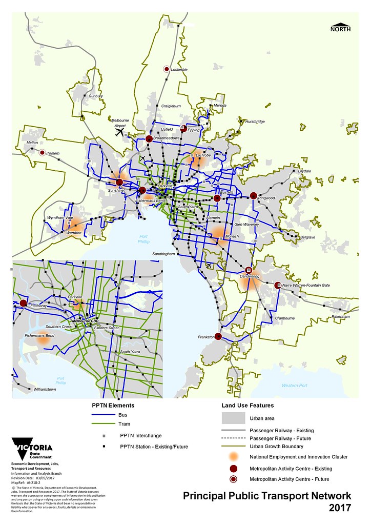
The PPTN is the Principal Public Transport Network. The state government describes it as follows:
The Principal Public Transport Network (PPTN) reflects the routes where high-quality public transport services are or will be provided.
It supports integrated transport and land use planning by encouraging more diverse and dense development near high-quality public transport to help support public transport usage.
In other words, it’s Melbourne’s attempt to tie good public transport into planning and land use.
For instance, recent changes to the state planning provisions include relaxed requirements for parking near the PPTN (section 52.06-5), and discourage major facilities from being too far from the PPTN (section 17.02-2S).
And it’s specific about what form the PPTN should take (section 18.02-2R):
- A metro-style rail system.
- Extended tram lines and the establishment of a light rail system.
- Road space management measures including transit lanes, clearways, stops and interchanges
It all sounds very positive. The theory of concentrating major development around good public transport, improving services, and allowing reduced parking can lead to good outcomes.
In effect it’s trying encourage development that will lead to people using public transport over cars, at least some of the time.
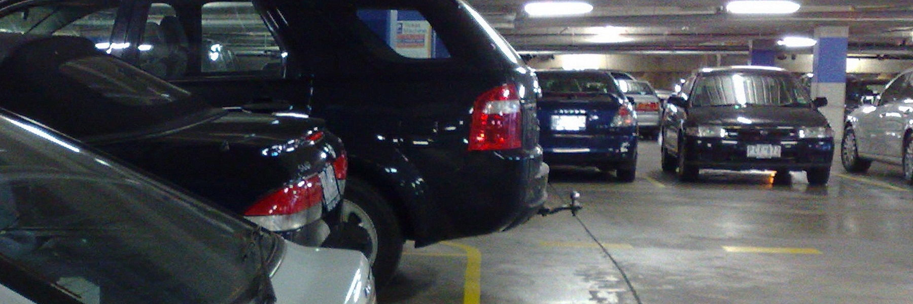
Residential parking
Residential car parking can get people very riled up. My reading of the current requirements is there’s currently no difference to off-street parking for residents, whether the development is on/near the PPTN or not. In both cases it’s:
- 1 car park for each one or two bedroom dwelling
- 2 car parks for each three or more bedroom dwelling
The only difference is that for developments not near the PPTN, there’s an additional requirement of one visitor car park per 5 dwellings in the development.
All this is a minimum. Property developers are able to build more car parks if they think their customers will buy them.
The problem is that car parks are expensive, especially the underground car parks normally associated with medium density developments of the type popping up around railway stations. Cost of parking adds to the cost of housing. And lots of car spaces encourages car ownership, and inevitably, car usage.
There are cities in the USA where they are completely removing the parking requirement for some homes around mass transit.
There’s no provision for this yet here, but the City of Moreland is seeking to override the rules, by allowing developments with no off-street parking in certain locations close to good public transport.
It’s not a requirement for no parking. Again, it’s up to the developers to figure out what the market wants.
These areas already have low rates of car ownership – so why not improve housing affordability for people who don’t want to own a car, or want to own fewer cars? As long as local streets have parking restrictions that prevent people parking lots of cars there instead, it can work.
(By the way, the Age’s story opens with: It’s a brave piece of social engineering – as if seeking to imply that requiring lots of parking isn’t engineering car dependency.)
Issues with the PPTN
I think the theory is good. But there are some problems with the PPTN as I see it:
The PPTN isn’t dense enough. It’s basically the existing train and tram networks, and some bus routes. If you assume that only the PPTN routes will be the ones that are really competitive with car travel, by providing long hours and fast, frequent service, there are some vast gaps.
Okay, so it’s just the principal network. Not every route can be part of it. But for instance, the PPTN includes no routes at all south of Frankston – not even to Mornington. That just seems illogical.
(More on this topic from Peter’s excellent Melbourne On Transit blog.)
The PPTN’s implementation is patchy. In fact, some of it doesn’t exist at all.
The PPTN mapping tool shows, for instance, a bus route along East Boundary Road, between Centre and North Roads. Good idea, except than no such bus route exists. One will be introduced in June, but it’s unclear how frequently it will run.
Even where the PPTN does exist, service quality varies widely, and it’s improving only very slowly.
It’s quite reasonable to assume that people living close to a railway station will (at least on the better served lines) be able to often use that service instead of driving. At the very least, they might be able to own fewer cars in their household than they would elsewhere.
The same might even be the case along some tram and frequent Smartbus or other high quality bus routes. But it’s highly unlikely along the many less frequent routes on the PPTN.
Buses can be improved, and relatively cheaply compared to major infrastructure projects. The bureaucracy has, or at least had, a plan to make them better. But it’s never been fully published, and there’s no hint of funding to make it happen.
This is not helped by literally billions of dollars instead being built on new motorways – the West Gate Tunnel (which includes substantial government funding, despite it being privately built) and the North East Link – which will only serve to help grow car traffic.
Great potential
The PPTN, and the associated planning provision, have great potential to help coordinate public transport and urban development.
But a lot more effort needs to be put into planning a more extensive PPTN, and of course actually implementing it.


9 replies on “PPTN – a good idea – in principle”
It’s high time the parking space requirements were changed. We don’t own a car (use car share when we need one) and yet was forced to pay for a car stacker so we could have the minimum 2 car spaces when we recently bought a new apartment that’s 30 seconds from a tram line and a 15 minute walk to the city.
It would have been better to define the pptn as a set of minimum frequencies within a walking (not birds eye) or distance from a stop in both directions, i.e. via the nearest set of pedestrian lights of needed, in time brackets, and say that the maps were an example of what this might look like rather than the actual gazetted areas.
If you don’t drive, why did you buy an apartment with such expensive parking ? Just a thought.
The concept of parking spaces tied to the number of bedrooms is strange. A working couple who both work and whose workplaces are in inaccessible locations, and don’t have children, are forced to buy a three bedroom apartment, why ?
In fact I am finding it hard to see how this new acronym actually adds any meaningful value to what is already known. There are train routes. There are trams. There are freeways. Who knew ?
jon: if you have unused car spaces that close to the city, consider renting it out to a long term “tenant”
A plan like the PPTN is an ambition, but the experience from the similarly framed Principal Bicycle Network is that it will be ignored by the road authorities and they will prioritise private motor vehicles or just completely leave out other users when building along the routes.
Parking minimums should be abolished and replaced, if at all by parking maximums. We don’t tell people how many lounge suites or toilets they must have in their building but we strangely do so for parking. Have a read of the publications of Professor Donald Shoup the author of “The High Price of Free Parking” at http://www.shoupdogg.com (or parkumentaries for the those who want it as videos).
meltdblog: It’s a good idea but most people are not going to rent a car space in a stacker when there’s an oversupply of unused parking in a lot of buildings already.
I live in an apartment in Brunswick and the two storey basement parking is never more than 2/3 full. It’s similar in most apartment buildings. There’s more parking than people who want to rent parking already.
One funny anomaly of the PPTN maps for Boroondara and Manningham is that the lesser parking requirements within 400m of a bus route includes the express bus routes that run along the Eastern Freeway. So you have all these local streets near the freeway that have a lesser parking requirement despite having no easy access to a PPTN bus route as all the buses run express past them on the freeway!
https://www.planning.vic.gov.au/__data/assets/pdf_file/0030/395580/PPTN-Area-Maps-Boroondara.pdf
[…] some gaps in the local network, including East Boundary Road (which is meant to be part of the Principal Public Transport Network, but currently has sections with no public transport), and sections of Tucker Road and Jasper Road. […]
[…] were using it, including some boarding and alighting at stops along East Boundary Road, which didn’t previously have any bus service. Not too bad given the unspectacular 40 minute weekend frequency and the fact that the route has […]