Well known public transport planner Jarrett Walker was recently noting the importance of having government services, particularly those targeted at low-income groups, close to public transport. Apparently this is often an issue in the US.
(Also on Mastodon here, but I can’t currently get Mastodon post embedding to work.)
I was curious: is he correct about Centrelink?
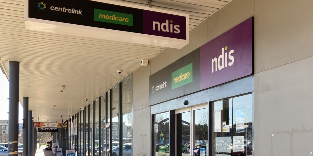
The short answer is yes. I looked at Greater Melbourne’s Services Australia locations (these incorporate Centrelink and Medicare and other services such as NDIS) and their major public transport nearby.
Most have tram and/or train within walking distance.
- Sunbury – train
- Werribee – train
- Watergardens – train
- Airport West – tram
- Broadmeadows – train
- Sunshine – train
- Footscray – train/tram
- Flemington – train/tram
- Brunswick – train/tram
- Preston – train
- Greensborough – train
- Heidelberg – train
- Lilydale – train
- Belgrave – train
- Boronia – train
- Ringwood – train
- Box Hill – train
- Glen Waverley – train
- Camberwell – train/tram
- Abbotsford – train/tram
- South Melbourne – tram
- Prahran – tram/train
- Oakleigh – train
- Cheltenham – train
- Springvale – train
- Dandenong – train
- Narre Warren – train
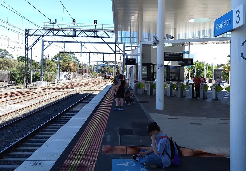
- Frankston – train
- Hastings – train – but the Stony Point train is very infrequent
- Epping – train (about 1km)
While these are close to trains and/or trams, in many cases the trams don’t provide a fully accessible service, which may be important to some users.
Most of these locations also have nearby bus services, which is important because people may or may not be coming from a direction served by trams or trains.
There are some other locations that are only accessible by bus. As we know, Melbourne’s bus services vary wildly in frequency, operating hours, and directness, so these may or may not be practical for people to use.
- Rowville – close to 6 bus routes, including 2 Smartbus (longer hours, higher frequency*) services, plus the Rowville FlexiRide service
- Cranbourne – about 1.6km from the station – but close to 4 bus routes
- Mornington – close to 3 bus routes
- Rosebud – close to 2 bus routes
- Melton – a few hundred metres from the main bus interchange, served by 6 bus routes plus the Melton South FlexiRide service.
(As with most things in Melton, the Centrelink is not nearby to the railway station – unlike many suburbs of Melbourne, the area was settled before the railway arrived, not afterwards.)
*Smartbuses are high frequency by Melbourne bus standards. But they’re not high frequency by Melbourne train/tram standards, nor by typical world city bus standards.
All of the locations in Melbourne appear to provide both Medicare and Centrelink services.
In regional areas there are also “Access Points“, providing phone and online access.
One notable absence is a Services Australia location in Melbourne’s CBD, though there are two within a few kilometres.
Of course in many cases the services formerly provided at physical locations have been supplemented or replaced by online services.

Overall, Centrelink/Medicare seem to have done reasonably well at locating their branches near public transport. Whether that’s the case for related organisations such as Workforce Australia providers (where people receiving support payments may be obligated to attend in person) is another matter.
A high quality public transport network will work for everyone, for a myriad of reasons. A key role is providing access to opportunity in big cities.
If the PT network doesn’t provide universally high quality service to everywhere (and ours certainly doesn’t), then locating the services that people need close to the better parts of the network can help a lot.
Lead photo credit: Tuggerong Services Australia, by Nick-D via Wikimedia (cropped) CC BY-SA 4.0
4 replies on “PT access to Centrelink”
The Sunshine Centrelink office is now over a kilometre from the station. It used to be located next to the station’s bus hub, which is the nexus for about a dozen routes. Ironically, the current Centrelink location is roughly where the the local VicRoads office used to be until that got moved into a new building complex…. next to Sunshine station.
The lack of a Services Australia office in Melbourne City is deeply weird. Until about a decade ago, an office existed at the corner of Swanston and Bourke St, about as central as could be desired. I was surprised a few years ago when I needed to attend a Medicare office and found I needed to hike out to Abbotsford, even though I was in the city to begin with!
I can only assume the city office was closed as a cost-cutting measure to avoid having to pay CBD rent. They would probably get a good deal on city office space today.
Oakleigh Centrelink is not really near the train station these days (they moved from Atherton Rd opposite Drummond Rd to all the way up past Atkinson St some years ago … and it’s up a steep hill so I wouldn’t want to have to get there in an unpowered wheelchair or with crutches etc.
There used to be Centrelink and Medicare at Altona Gate, both which closed and was replaced with a set at Newport, which was more convenient for PT. However, it has since closed, and it’s sad to know that there’s none in Hobsons Bay now.