When updating the level crossing removal list last month, I was interested to see how many of each type of removal had been used.
Broadly speaking there are five methods.
- They can rebuild the road to go over or under, to avoid touching the rail corridor.
- Or they can rebuild the rail line to go over or under – which depending on location may also mean a new station.
- The fifth option? Closure. If the crossing gets light road traffic, and particularly if nearby roads no longer have crossings, sometimes government will simply close the road. In most cases in urban areas, they leave pedestrian/cyclist access, to avoid those users having a long detour.
So how many of each have been used to remove recent crossings? This surprised me.
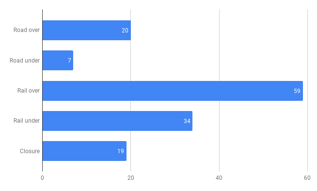
This is based on all the crossing removals I can find since 2007, including some in regional areas. It’s not just those done in greater Melbourne since 2014 as part of the Level Crossing Removal Project.
EDIT: The numbers are based on those removed from the ALCAM top 300, so are missing some regional crossings.
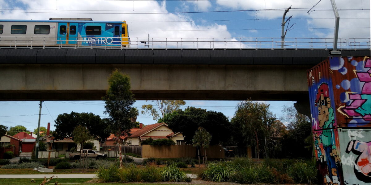
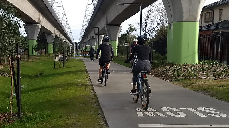
Rail Over, sometimes known as “skyrail” for instance along much of the Dandenong line – involves an elevated rail line. Modern designs allow for public space or car parks underneath.
Despite the controversy over skyrail, rail over has been used for more crossing removals than any other method, with 59 projects (42%). I’ve included Seaford Road, which was a hybrid design, with elevated rail but the road also lowered slightly.

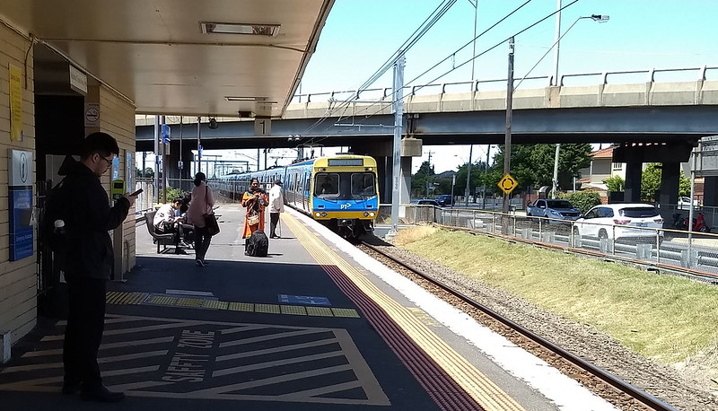
Rail Under for instance my local station at Bentleigh, involve a trench for a distance, getting the rail line out of sight but making additional crossing points difficult.
Theoretically rail under can include a deck over the line to provide public or development space, but this is pretty rare due to cost.
Rail under is the second most common solution, but is in fact a minority of projects, 34 projects (24%). I’ve included Mountain Highway, which was a hybrid, with rail going under but the road raised slightly.
Road Over, was used a lot in the past, for instance at Newport, Jacana, West Footscray, Euroa, Oakleigh and Huntingdale, pictured below. This method is pretty problematic in built-up areas, particularly for pedestrian and cyclist access, so it’s disappointing to see recent examples including Hoppers Crossing, Aircraft and Werribee (Cherry Street).
Many of the recent ones have been in regional or outer-suburban areas such as Pakenham where perhaps it’s not as bad… though over time, outer-suburban areas may become built-up, which makes me wonder if it’s a mistake to use them anywhere in an urban area. They’ve made up 20 projects (14%).
Road Under isn’t very common. One notable recent example is Essendon, which has not been a great outcome in my view – it’s difficult for cyclists in particular, and the old station still isn’t fully DDA-compliant. In total road under has been used for 7 projects (5%).
Closures can be controversial, with recent announcements such as Champion Road in Newport and Latrobe Street in Cheltenham drawing ire from locals – though it doesn’t seem to have lost the government any local seats during the recent election, despite the Liberals campaigning on it. My view: if it’s only a minute or two’s drive to another road, which is now free of a crossing, then people may not like it, but they’ll probably get used to it.
Anderson Street in Yarraville is also set to be closed, but hasn’t drawn the same controversy, perhaps because it’s a basket case for drivers anyway – most people seem to avoid it, and it’ll enhance that area as a “car light” precinct, emphasising pedestrians.
Closures account for 19 projects (14%), many of them in regional areas. This number includes five in Wodonga where the rail line was moved rather than the road closed.
The different methods have pros and cons, and what’s possible in one location isn’t necessarily possible in another.
Rail Over is pretty much unique in making possible the addition of community space. It’s often criticised by locals beforehand… only to be mostly loved afterwards, for instance: Dandenong line, Carrum.
Given the generally good public space outcomes, it’s somewhat comforting that they’re using it a fair bit, despite the controversy… though perhaps that’s part of what ensures the good outcomes.
- This 2016 RMIT study looked at methods of grade separation from 1859 to 2010. I’ve also got a blog post summarising it – including some good comments critiquing the study.
- The full list of crossing removals is here – use your browser’s Ctrl-F Find function to find specific projects or methods
- If you spot any errors, let me know in a comment!
9 replies on “How do they remove level crossings?”
Is there any material online about how they actually construct sky rail over a (mostly) live working railway?
Looking at the Upfield corridor that’s due for removal it looks too narrow to put in Y shaped colums either side of the railway tracks, yet to have a single column would involve moving one or both tracks. Of course I’m sure they know how to do this based on previous projects.
For upfield they have always said they would need to close the line for construction. This is also what happened when they did the Moreland and Coburg stations.
@Guy, not sure what material is available about this. For the Upfield line the rail corridor is mostly quite narrow.
On the Dandenong line they had a bit more room to play with – and huge numbers of passengers probably motivated them to find solutions to mostly keep trains running.
Carnegie August 2016 – new overhead wire gantries to provide space to build the elevated structure around it https://www.flickr.com/photos/danielbowen/28881234440/
Murrumbeena March 2018 – this shows how the new structure fits with the temporary gantries and narrowed platform
https://www.flickr.com/photos/danielbowen/40854187951/
Carnegie June 2018 – removing the old track https://www.flickr.com/photos/danielbowen/41985107035/
Murrumbeena June 2018 – temporary new station entrance https://www.flickr.com/photos/danielbowen/29004509348/
I think most of the longer closures (a few weeks) were to build the ramps up and down, and plug in the skyrail track to the existing track, which couldn’t be done while trains were running.
(hmm maybe I should expand this into a blog post)
Road over and closure are actually more common that stated above because of other level crossing removals, the rest of the Wodonga Rail Bypass, the Closure of the South Gippsland Railway and Princes Freeway/Highway upgrades between Geelong and Colac. I noted the ones between the list of the ACLAM top 300 and the 3 crossing planned by the current government not in the top 300, in my comment on the November post:
https://www.danielbowen.com/2022/11/05/level-crossings-nov-2022-update/#comment-348953
D’oh good point Tom, yes of course, I’m only counting the top 300. I’ll add a note in the text.
Oh that obnoxious Level Crossing Removal Project website! for all the heavily massaged “communication” they seem comedically shy about sharing any maps/layouts/plans, the one thing that would communicate the projects so clearly and quickly. Of course the plans were in flux and what is delivered generally did not match the original architects vision, but to share nothing even after completion is a joke. The secrecy around it only made/makes the locals more worried than needed.
What I find very interesting about the Frankston line level crossing free by 2030 is that basically almost every train station would have been rebuilt by the LXRP on that line. Only Patterson (opened in 1961) , Moorabbin (rebuilt in 1958) and Kannanook (opened 1975) remain. The rest will essentially be basically all rebuilt.
[…] Anyway, here’s something related – an expansion of a comment answer I left on a recent post. […]
[…] Daniel Bowen (Public Transport Users Association): How do they remove level crossings? https://www.danielbowen.com/2022/12/21/how-do-they-remove-level-crossings/ […]