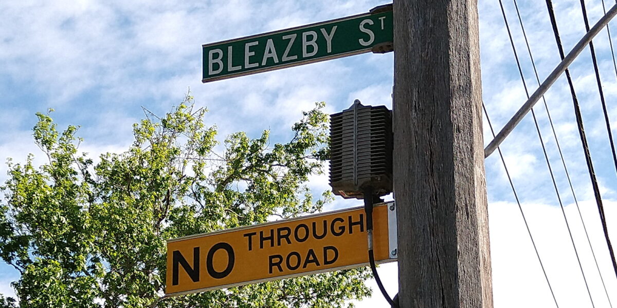
When is a No Through Road sometimes not a No Through Road?
When you’re not driving.
It’s common to see this signage around the place, but it’s misleading because it often only applies to vehicle access.
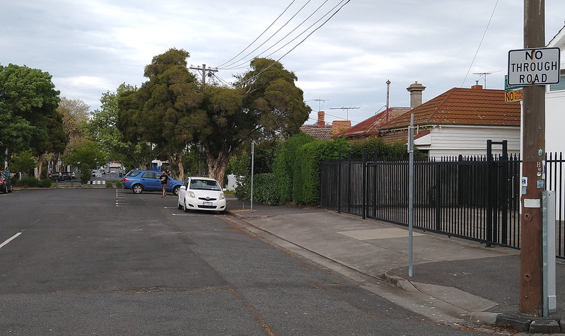
There are a lot of cases where pedestrian and cyclist access is provided at the end of the street, including dedicated paths, and increasingly, “parklets” where a small section of street has been closed to road traffic.
Online maps will often show paths, but not always. (In the examples shown here, both Google Maps and Melway online score full marks, 3 out of 3, though the Melway markings for Leeds Street are ambiguous for pedestrians.)
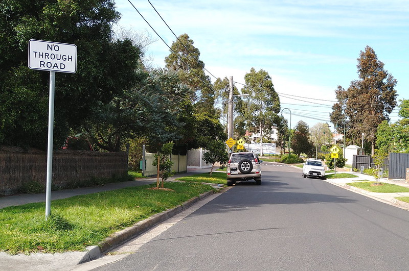
Finding these additional routes is important for those travelling under their own steam, where shortcuts can mean a big saving of time and effort (doubly so for those with mobility difficulties), or avoiding too much walking in the rain or alongside noisy polluting heavy traffic.
They are particularly useful at the moment when you might want to go walking along a route that’s less busy with pedestrians, so that maintaining physical distancing is easier.
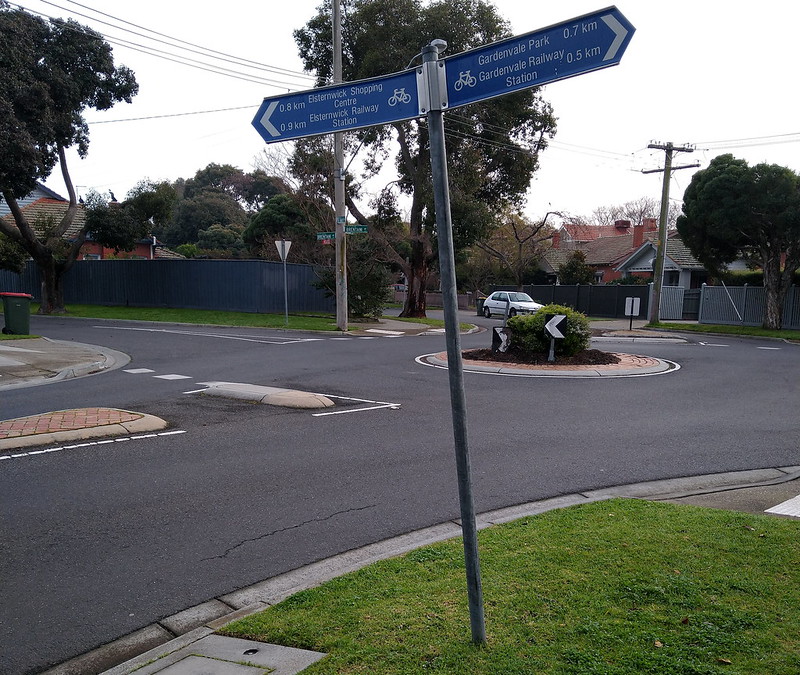
Sometimes you’ll see wayfinding signage for pedestrians and cyclists, but it’s not very common. Maybe there needs to be more of this, targeted at accompanying the “No Through Road” signage where that only applies to vehicles.
Otherwise, I wonder if some other terminology and/or symbol should be found that is more relevant to everybody, not just those who are driving?
14 replies on “When is a No Through Road not a No Through Road?”
There are also examples of ‘road closed’ at a railway, but pedestrians still have a level crossing.
https://wongm.com/2017/06/closing-roads-remove-level-crossings/
It’s never really occurred to me but it is a good point. In my experience Google Maps does a pretty good job at showing walking lanes and other pedestrian paths. But the signage is just another example of how geared towards the motor car our road authorities and society really are.
I have noted a number of these pedestrian walkways which were not on google maps and requested they be added by google. I have been sucessful with just one, the rest are all ‘pending verificiation’. But agreed, the signage should be modified to reflect the wayfinding requirements of all users, not just motor vehicles
Your photo of blue signs in small font with bicycle symbols and directions to a park and railway station is very timely.
Bayside council has a lot of these signs that purport to be the Council doing something to encourage cycling. What rubbish! These signs are just an easy way the council has of spending money out of their transport budget to pretend they are promoting cycling. Apart from ridiculous small font, the signs can be read by motorists, pedestrians as well as cyclists, so pretending they are for cyclists is dishonest. Also, in most cases, the signs point down an ordinary road where the council has done nothing to make the route safe for cyclists. No cycling lane. No bike path. No barrier between cars and bikes. Just like an episode of ABS Utopia, spending money and promoting yourself is the key objective over actually doing something constructive.
Walking paths and tracks seem to generally be better in https://www.openstreetmap.org/ than Google Maps. YMMV.
When I lived in Tyler St. Preston I often took the Darebin Creek Trail then over a pedestrian bridge to access Oriel Rd. where I then took route 350 as a fast route to City, or in later hours take route 250 back, as its sister route, route 251 to Northland had (or perhaps still has) an earlier finishing. I wouldn’t be surprised if I’m the only one that has used this combination of paths and bus routes.
I just checked my area in St Kilda where there are many back lanes. Google Maps covered all of them, Melway Online none of them and Apple Maps didn’t even get my street name correct.
@Roger – I can’t speak for Bayside, but i have often noticed this kind of signage in the inner north on roads that don’t have specific provision for cyclists, however they are generally ‘cycle friendly’ local roads to often provide a short link between sections of better cycling provision. This form of way-finding signage is important. If you are following a good on road cycle path that suddenly ends, without this signage you have to take a punt on the best direction to head. Sometimes a left turn puts you onto very ordinary, busy roads, whereas a right turn might see you rejoin a proper bike lane in a couple hundred metres. The way-finding signage takes the guesswork out of that decision.
@Gobilllino. Thanks for the feedback on your local area. Alas, in Bayside, that is not the case. Bluff Rd Hampton which is signposted with similar “bike” signs is a good example. Cars are parked on the side of this busy main road making it tricky for motorists who need to constantly change lanes but this road is deadly for cyclists.Apart from erecting a sign, Bayside have not improved this road for bikes at all.
BTW, your reference to “on road cycle path”, I assume you mean “bike lane”. While slapping paint on a busy road and calling it a bike lane is better-than-nothing, a true bike path, separated from cars by a barrier, is far more cycle friendly.
The no through road signs should have pedestrians excepted/cyclists excepted where the no through road does not apply to them.
@Roger. Sorry, I worded it clumsily, but by ‘on road bicycle path’ i was actually referring to a route making use of a road reserve, as distinct from an off-road path. This could mean painted cycle lane on the asphalt, shared path, cycle only sections, protected lane etc. Through Brunswick and Coburg the main north-south connection feeding into Canning Street features a mix of all these things (including painted lane on local, low speed streets, which to my mind can be quite effective, in contrast to the tokenistic on-road provision you’ve described in Bayside). This route does snake through some side streets and cycle-only mid block connections though, and without the way-finding signage it would be difficult to navigate.
There’s another situation where this is the case here: https://goo.gl/maps/hqHspKAyXUpdSQwU8
Telford Road is marked as No Through Road, but turns into Old Coach Road, then White Hill Track which then you can get to Acheron Way via Fischer Creek Road.
However, the part of Telford Road beyond where it meets that unnamed north-south straight road, and onwards from there to the others I’ve mentioned are gazetted as 4WD only (it’s a bit of a complaint of mine that Google Maps does not show this in any way) – so it’s not open to all types of car.
I think there’s a sign that says “4WD only beyond this point”. The street view car didn’t drive down the 2WD section, so I can’t check :)
I have a joke answer: When it’s a COVID roadmap that feels like it will never be successful
Also notice this is apt to the time period this blog post was published.
*But actually is successful.