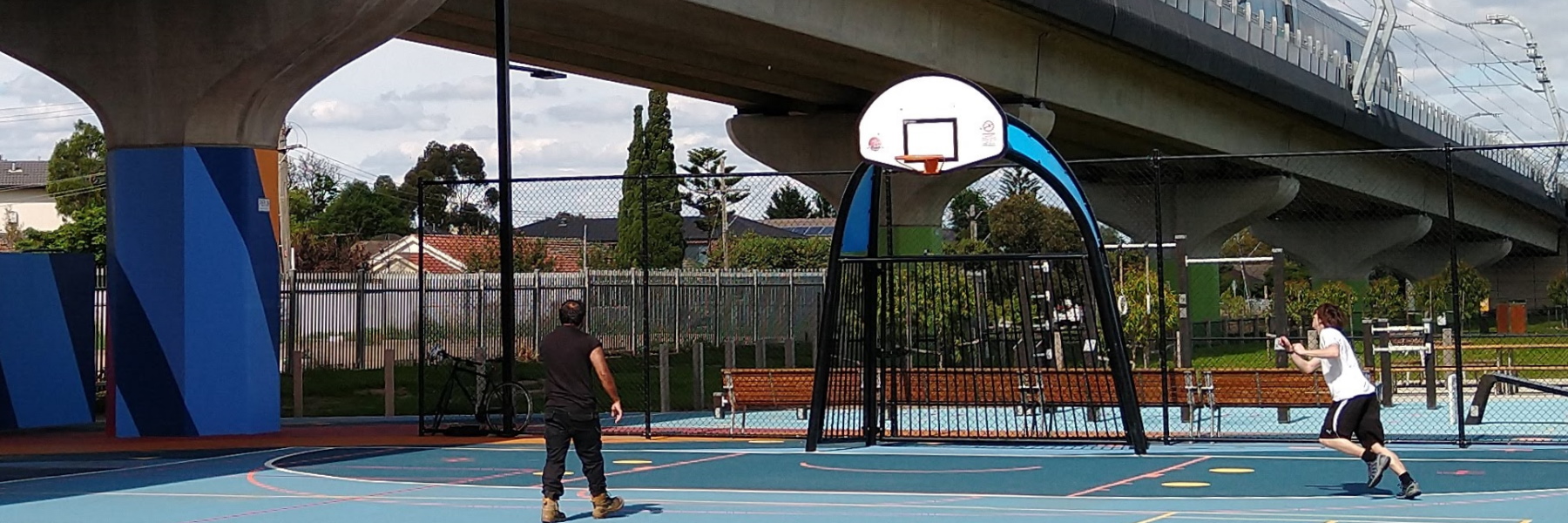
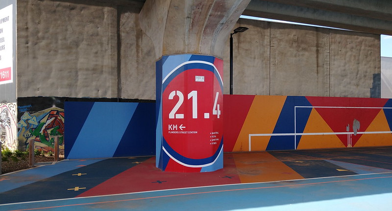
Unlike most of the spots where skyrail replaced level crossings on the Dandenong line, this area at Centre Road (Clayton South) has no station.
I happened to stop past there on the public holiday Monday and was interested to see the different groups using the space.
Overall it looks pretty clean. Note the graffiti mural on a nearby wall, but not on the skyrail supports themselves, which have official markings no doubt to discourage tagging.
Basketball areas seem to be well used.
Here’s a special dog off-leash area. I didn’t see anybody using it.
The Djerring trail (shared use path) seems popular with individuals and groups. This seemed to be a family all out together.
Centre Road here has two T-intersections, thanks to where the level crossing used to be. I was surprised they didn’t change this, but on the bright side, leaving the road layout as is means Djerring trail users only have to cross once to continue their journey. (Other footpath users may not be so lucky.)
Overall the space looks clean and well used by locals, and hopefully it’ll stay that way.
Over in Williamstown they’ve reached a decision point for the Ferguson Street level crossing removal: rail under, or rail over? Both have pros and cons, but the open space is something rail under simply can’t provide.
Meanwhile in other news, former PTV CEO (now Department of Transport head of services) Jeroen Weimar has resigned effective next month. He’ll leave some big shoes to fill.


6 replies on “Under the skyrail at Clayton South”
It will be interesting to see how the space under the Toorak Road level crossing will be finished. This is also a location with rail over and no station facilities. I am curious to see how they finish the area, give the massive cash splashed on the first couple of skyrail locations intended to win people over, vs a later crossing where skyrail is more accepted by the community.
Driven under the bridge lots of time but never realised the work they did to the space underneath. It’s a very busy area so you would expect usage of the area as long as they can manage the vandalism that sometimes comes with it.
I ride through there fairly often, the dog enclosure gets plenty of use at dog-walking times of day! The beg-button light to cross Centre road seems to have a long time delay from push to green-light, but no different to most other low-priority crossings (ie pedestrian or bike crossing a road). I think LXRA are still clearing any graffiti off the pylons pretty much as soon as it appears – Some parts of the path are starting to crack and break up already from the trucks that drive along it for maintenance :( To anyone riding on it near the stations though, WATCH OUT at the car park entrances. The cars crossing the trail are meant to give way and there are stop signs/give ways to tell them, but most of the drivers either don’t know or don’t care. Your photo of a family riding along it is fairly indicative, you’ll meet groups heading in both directions riding like that, same with walkers, some on the left, some on the right, some down the middle, some spread out across the whole path
weren’t those viaducts supposed to be split longitudinally to let more sunshine through them, or something like that.
I’m definitely a fan of Skyrail, it creates much more space and allows you to forget about the rail line. Also a great view when riding the train (if your not looking at your phone anyway!). Can’t wait to see Mooroolbark and Lilydale completed.
On a side note, the glass at Clayton station look like the have not been cleaned since the day it was finished, looks terrible. Why cannot there decent cleaning and maintenance?
Pretty much the same thing at Ringwood, my home station, apparently the stainless steel bits and prices never ever need cleaning.
whilst there is ‘open space’ at ground level, the overall visual impact is horrid ugliness.
As for the Williamstown example, I dispute your conclusions. As a local resident who knows the area well and who has perused the plans I can tell you the ‘open space’ to be created will be minimal if any at all with raised rail. The raised design is a rail bridge, 900 metres long that will have to taper down to ground at both ends, so you lose ground there first up. It is NOT continuous skyrail of the kind shown in your pics. Then out of this you have to take out the area covered by the existing roadway, the heritage station buildings, and the new elevated station to be built. Thus the total ‘clearspan’ available for ‘open space’ is minimal to zip, perhaps the area between the 2 heritage station buildings currently occupied by the tracks. And even this will be directly underneath the raised rail, in shade for most of the day.
In contrast, rail under of the example being built at Mentone (which has a very similar layout to Williamstown by the way) provides a lot of new open space as they are covering the trench between the roadway and the heritage station buildings, with the new underground station being built beyond the existing station buildings. By far the best solution for Mentone and one which would work very well in Williamstown and which is supported by many in our community.