
My car has a spot in the central console area thingy that looks like it has been designed to store your mobile phone so you can kind of see the screen while driving, for navigational purposes. At least, the manual doesn’t seem to document its purpose, and I can’t figure out what else it could be for.
A few months ago I had to drive to Balwyn to pick up a batch of stuff to bring home. My navigational skills for this part of the world are a bit hazy. Anywhere north-east of Kew, and I’m a bit lost.
So I tried out the Google Maps navigation in my phone. I’ve used it plenty of times for planning trips on public transport or on foot. And occasionally when driving I’d use it to check road conditions, but I hadn’t used it in fully-blown GPS mode before.
I have to say, I’m impressed. Pump up the volume and it reads you all the directions as you travel along, including details like pointing out when you might have to be in the left lane to turn right.
(Supposedly, dedicated GPS units are better than using phones, but given how little I drive, I’d struggle to justify it.)

It would be interesting to understand the algorithm, but from my observations:
- Time appears to trump any other consideration. Save one minute by using a toll road? It’ll suggest it, unless you set the options to exclude toll roads. But there’s no option to be selective about it – maybe I’m willing to pay $3.18 for the Bolte Bridge, but not $8.27 for the Burnley Tunnel and M1.
- It seems pretty good at avoiding big traffic snarls.
- In the case of the trip from Bentleigh to Balwyn, it took me on a route which I totally wouldn’t have chosen myself, along numerous minor roads and side streets.
I find this last point interesting. If I’d planned it, I’d have taken a longer route along main roads – because they’re easier to navigate if you’re unfamiliar with an area and aren’t being given directions.
If the algorithm prioritises time over everything else, presumably it’s sending a lot of motorists down streets that previously didn’t get much traffic.
Other GPS systems are probably doing much the same thing – this article goes into some of the technical detail.
Some communities are fighting back, particularly in the USA where perhaps more people are using them. Apparently the town of Leonia, New Jersey has closed numerous streets to all vehicles except local traffic. And there other strategies some are employing:
Since Waze uses crowd sourcing to update its information, some people – frustrated at the influx of outside traffic – have taken to fabricating reports of traffic accidents in their communities to try to deter the app from sending motorists their way.
Oddly, the article doesn’t mention the measure that I would consider the most obvious: traffic calming to reduce overall driving speeds. Off the top of my head these might include:
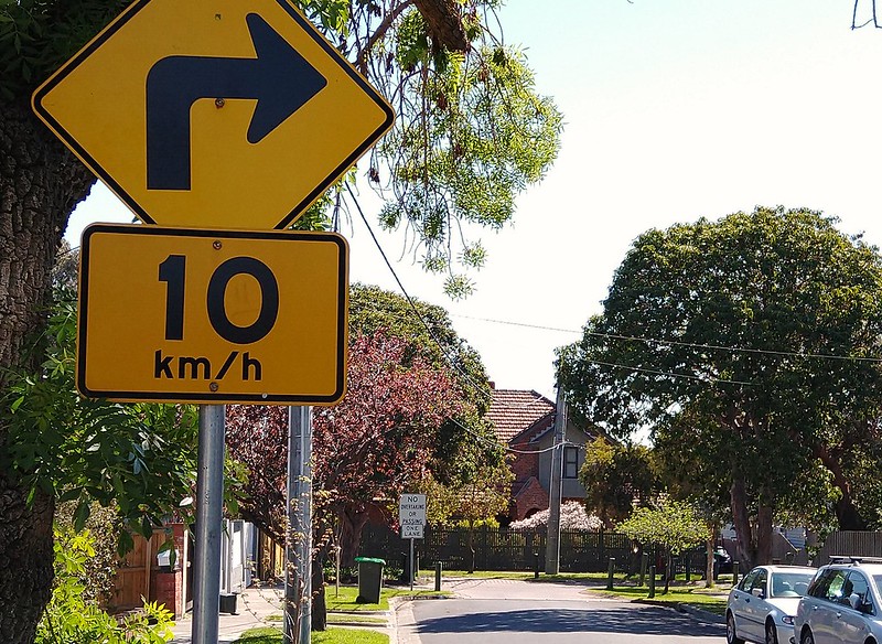
- Reduce speed limits
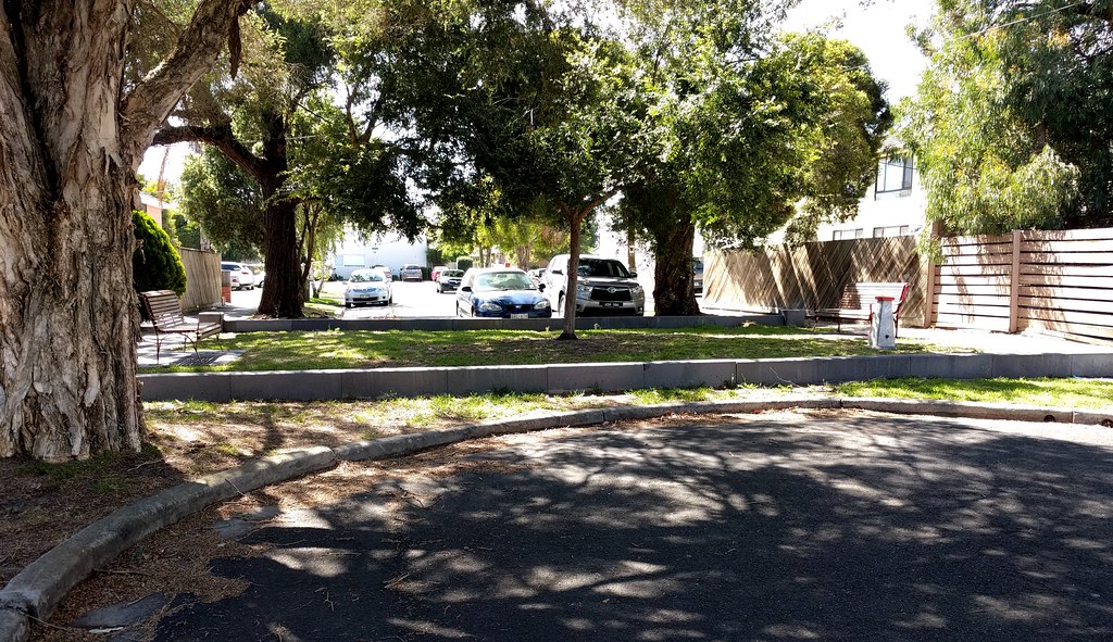
- Closing off through-streets to create cul de sacs for traffic (see above; preferably still allowing pedestrians and cyclists through)
- Speedhumps and chicanes (see below) to slow down cars
- Turn or through-traffic restrictions at intersections (a recent high-profile example is Toronto’s King Street)
And I’m sure there are other measures that can be used. In my own local area, Glen Eira has implemented a number of these measures on side streets – great to see.
After all, if the algorithms are giving people the fastest route no matter what, then making residential side streets slower and less convenient might be the only way to ensure that quiet streets stay quiet.
And even better, it also makes life better for cyclists and pedestrians using those streets.
12 replies on “Hey Google, tell me where to go”
I think there should be a part of the algorithm to prioritise taking main roads over residential area roads (i.e. Doncaster Rd over High St) and furthermore highways over main roads (i.e. West Gate Fwy over Kororoit Creek Rd), like introducing a hierarchy system to Google Maps and not simply defaulting to time and length and taking in minor residential areas. The street I live on (Swan St, Tuart Hill, Perth) was a major rat-run until the council set up left-turn only medians at every junction with a main road; perhaps that’s what other councils should do as well. It is still a rat-run for people only needing to get through but much less major (and on occasion you still get the daring driver who ignores the left only signs and makes it just in the nick of time).
The algorithm definitely prioritises even the smallest of time advantages. I end up using Google Maps to navigate towards the end of peak traffic as it can be handy to be notified about crashes or other delays.
I can think of at three locations where it wants to take me down a side street to save one minute, but I know the right turn at the end is across a major road that usually takes longer than a minute to get safely through, so much better to go down a nearby road where I know there are lights to make that right turn easy.
Even if a little slower, I prefer to stay on main roads. My partner asks me why I ignore the sat nav? Well, if I do vaguely know where I am going, I stick to the main roads. Countless times I have made the journey from Melbourne to Phillip Island and I know the way, but I did just check Google Maps on my desktop before we left for the travel time and its fastest route and alternative routes were not the way anyone would normally travel to the island. I agree. Mapping systems should generally stick to main roads and not residential streets.
Mapping systems generally have a priority system where higher-tier roads like freeways are preferred over the side streets, but if the difference between them is more than a minute or two, some systems are likely to go with the more complicated “rat-running” route just to save a few minutes.
An algorithm to avoid “back streets” and “main roads” might be slightly difficult, due to the fuzzy nature of what counts as a main road and what counts as a back street (far from impossible, though). I think the low-hanging fruit would be a tick-box that says “fewer turns”.
From my armchair, the number of turns seems like a nice proxy for the simplicity of the route – it would be analogous to the “fewer transfers” option it has for public transport.
Usually the “easy” way is to follow major roads for most of the distance, with only one or two places where you need to make a turn – whereas taking backstreets tends to require you to make many more turns to zigzag through the backstreets. In addition to taking you through residential streets that might not want you, the complexity and uncertainty are likely to make the drive more stressful and even potentially slower (as you drive more cautiously, “hang on, am I turning at this corner or the next one?”). Which may not be a bad thing for safety reasons, but does mean that the claimed 1-2 minute time saving is likely to evaporate.
“Speed humps and chicanes”. Also roundabouts.
These are good traffic measures – except when you’re on a bus!
The narrowing to a single lane is a clever self limiting effect, little to no impediment/delay when its not busy but very rapidly congests with increasing traffic. On treatment you haven’t mentioned is partial intersection closures, I’ve not seen any in Melbourne but you can turn a crossroads into a pair of corners that doesn’t close the streets but reduces through traffic:
https://safety.fhwa.dot.gov/speedmgt/ePrimer_modules/images/tceprimer108.jpg
https://safety.fhwa.dot.gov/speedmgt/ePrimer_modules/module3pt3.cfm
it would be nice to tell it “if the time difference isn’t greater than 5min, don’t bother me about it” or similar … very unlikely that this is going to happen mid-way through a journey however
Hi Daniel et al,
There is little evidence that the algorithm sends people down residential rather than main roads. The US example are mostly Nimby groups where public roads built with tax payers money have been restricted often illegally, but at least unethically, by “residents groups” or developers, then complaints arise from usual traffic flow. It is real estate PR 101. I am sure you will remember similar issues. When the Brisbane council started putting up boerdwalks along the river, and started the city cat service. Months of complaints about how this would increase crime and cause congestion.. mainly from property owners how had illegally extended there properties to the riverfront across this public land.
I’m surprised that it’s taken you so long to use this feature on your phone! I’ve been a dedicated Melways user but discovered that the phone maps are great although like other commenters, I don’t always use the recommended route but it is useful to see the traffic congestion.
I’m also surprised about the app taking you on smaller roads, that has not been my experience at all.
I’m a fan of being guided onto smaller roads. I think this helps to spread traffic more thinly and evenly across the public road network. Every car using a side street is one less jamming up the main road. After all, you don’t want all your jam in one spot on your toast, you want it spread out evenly.
I believe that there may be some NIMBYism in emotive terms like ‘rat run’ that make using public roads into a ‘wicked’ or ‘hostile’ act. What they mean IMHO is “This is MY road, how dare you use it”.
@Brian: I advise you to stand outside Costco in Ringwood any day of the week (not counting public holidays) when the sun is up. Bond St and New St is bumper to bumper even when the traffic on the main roads (Maroondah Hwy, Eastlink, Ringwood Bypass) is actually flowing. It’s not because of Eastland, or Costco, but because all the cars are avoiding half a dozen traffic lights everywhere else. It’s only after 9PM when the traffic dies down.