A couple of newish things in the world of public transport info that have flown under the radar.
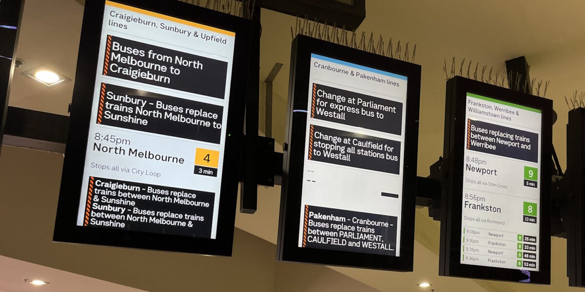
Metro now has realtime info for rail replacement buses.
Perhaps it’s a soft launch because I can’t see a link to the info on the excellent Planned Works page on their web site. Instead, if you browse to Lines and Stations and find the station, it’s shown at the top of the page when the buses are running.
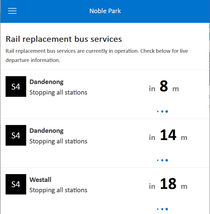
Given ongoing bus replacements, this is pretty handy.
You can also see scheduled times on apps such as Google Maps, but it does not appear to be realtime. Hopefully this happens soon.
Speaking of which: V/Line is now providing realtime info via GTFS, so apps such as Google Maps can see it.
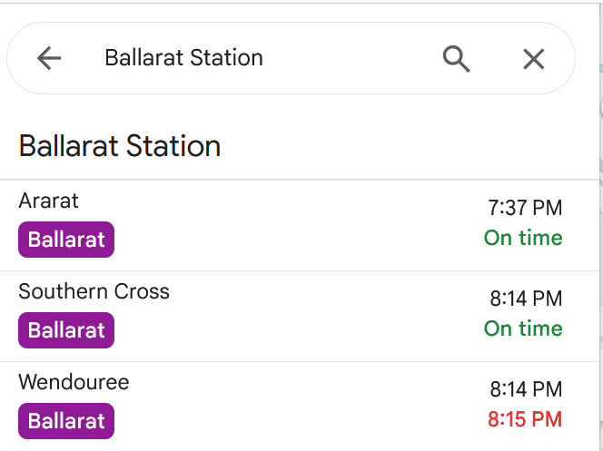
Both handy improvements, good to see.
12 replies on “More realtime info”
I’m guessing this is not available on every replacement service. I can’t seem to see it for the Werribee line where they are doing train testing on the line.
My mistake, I see it now, but only on their website on the desktop site.
@Arfman, hmm, working for me on desktop and mobile.
eg. https://www.metrotrains.com.au/stations/montmorency/
Incoming wall of PID rants:
I wish we could have some proper realtime public transport info instead of just a couple of PIDs per station and at a handful of tram and SmartBus stops. Aside from the obviou$, why can’t station platforms have a few sets of PIDs spread out across the platforms showing trains as well as nearby trams and buses instead of just one or two sets of next train PIDs near the entrance like we’re still in the 1920s with the old pull-down signs?
Newer station builds like Greensborough (trench) and Lilydale (skyrail) are so close to getting it right (in that they have both train and bus PIDs) but still fall flat on their face with the execution. Don’t just plonk the bus PIDs at their respective bus stops right next to the paper timetables, they need to be everywhere – at the entrance to the train station as well as the concourse, waiting room and at least three along each platform so that you can see them from any carriage. Likewise with next train PIDs, don’t just hide them on the platforms or at the customer service counter like the City Loop of all places, they need also be visible from the street and the tram/bus stops.
Jolimont station is a joke when it comes to PIDs, the only two train PIDs are on the platforms hiding under the verandah out of sight, so if you’re up top on Wellington Pde or at the tram stop (also, why is that oddly-placed myki machine not at the tram stop?) you don’t have a hope of seeing when the next train is unless it shows up at that instant (which by then you’ve already missed it if you were still at the tram stop).
The biggest slap in the face though are the rainbow boards outside the City Loop stations which only show you whether trains are running or not, while you still have to go all the way into the station proper to actually see the departure times. Not everyone has access to the PTV app (e.g. flat battery, poor reception, app won’t load, or simply no phone at all), as much as the government would believe by spamming it endlessly on thousands of posters at each bus stop where an actually useful area map used to be (not to be confused with the route map which also used to be shown, but a proper Melway street map).
When a bus or tram arrives at a stop shared with or connecting with another route, it should announce the connecting route(s) like trams do but also show the next departure time of said route(s) on the screen if it has one (e.g. C class trams and late-model Ventura buses) so that you know it isn’t a complete waste of time changing for a bus that is an hour away while also missing your (possibly also hourly) bus by having to get off to check the timetable on the other side of the intersection.
Also, someone get Kinetic drivers to turn on the SmartBus PIDs for once, or at least automate the PIDs so they are always enabled when the desto is set, don’t make it optional extra that might just work on a 900-series route once in a blue moon. Every bus route too, not just SmartBus; unless there’s been an update in the last ten years which removed the functionality, every single bus stop on the entire (ex-) Transdev network should show up on the PIDs. Not sure about the ex-Dysons routes that went to Kinetic, but I know that even new stops are still being added to the system, albeit without audio recordings e.g. Hender St (which replaced Doncaster Park & Ride inbound when the latter was demolished for the NEL/busway works), and the stops along Burwood Hwy and Elgar Rd when the 903 was rerouted via Deakin Uni (formerly via Riversdale Rd).
Heihachi_73 – they are all valid rants!
Proper Melway maps would definitely be welcome at more bus stops, railway stations and tram stops.
Here in the west, some of the stations have the PIDs for trains at the bus interchange area (I’m looking at you St Albans and Sunshine), but sadly, PIDs for buses are wanting. Some of the bus interchanges on the Sunbury line have more buses (but no PIDs), but some stations on the Frankston line have PIDs for only one route. For example, at Watergardens we have nine routes (all but one are CDC Melbourne, with 420 being Transit Systems), and it is hard to know which bus arrives (or how long until the bus you need to catch arrives). So I agree, we need more PIDs for buses at stations in addition to PIDs for trains that you don’t need to go to a platform to see.
Great points on the need for more improvement for Passenger Information Displays (I’ll spell out PIDs for the benefit of anybody not aware of the acronym!) around the network.
Middle Footscray (as of a month or two ago when I was last there) seems to be one of the last suburban stations left with no real-time display at all.
East Malvern also has no PIDs despite being classed as a premium station! not that there’s anything even remotely premium about platform 2, or its gigantic non-accessible, steep, vertigo-inducing ramp (see also: Kananook, Watsonia).
No PIDs at Kooyoung, Macaulay, Flemington Bridge, Royal Park, Jewel, Brunswick, to name a few more…
*also like to add to my comment, the PTV app used to list which stations had PIDs in the station info screen, by clicking the little ‘i’, but this has been removed. Maybe Transport Victoria aren’t too keen to point out which stations have and don’t have PIDs…
Except google maps suggests that every V/Line service departs from Platform 3A at SCS. Not user friendly for tourists or infrequent users at all!
Outside Tarneit Station there are 9 stops I think along a U-shaped area with a barrier between 2 sides of the U shape. Each bus stop has a PID. Initial reaction would be “Great”, yea? But each of these PIDs shows the departure times for only the routes for that particular stop. This needs to improve so that the PIDs will show the departure times in say 5 minutes for all buses and which stop # so one does not have to run to the other stops to check for connecting route.